 Betteshanger
Lynton
Amesbury
Marlow
Burford
Chipping Norton
Marlborough
Cairnryan
Lydney
Betteshanger
Lynton
Amesbury
Marlow
Burford
Chipping Norton
Marlborough
Cairnryan
Lydney
Lurgan Park on the map, Craigavon, United Kingdom
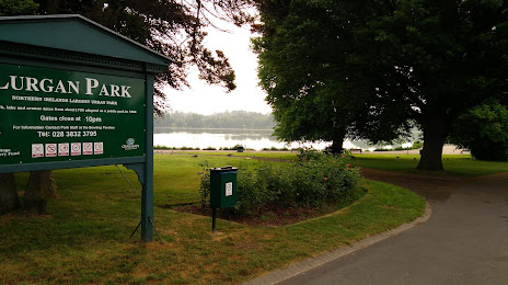
Photo
Where is located Lurgan Park
Lurgan Park — local attraction, which is located at Windsor Ave, Lurgan, Craigavon BT67 9BG, United Kingdom and belongs to the category — park. Average visitor rating for this place — 4.7 (according to 1801 rating, information from open sources and relevant for 2022).
Exact location — Lurgan Park, marked on the map with a red marker.
You can get directions to Lurgan Park on the map from your location.
What else is interesting in Craigavon? You can see all the sights if you go to the city page.
Coordinates
Lurgan Park, United Kingdom coordinates in decimal format: latitude — 54.464363801749926, longitude — -6.3262798746642375. When converted to degrees, minutes, seconds Lurgan Park has the following coordinates: 54°27′51.71 north latitude and -6°19′34.61 east longitude.
Nearby cities
The largest cities that are located nearby:
- Belfast — 36 km
- Dublin
 (Ireland) — 121 km
 - Glasgow — 207 km
- Liverpool — 253 km
- Preston — 254 km
- Edinburgh — 260 km
- Blackburn — 268 km
- Manchester — 295 km
- Cork (Ireland) — 315 km
- Huddersfield — 316 km
- Stoke-on-Trent — 324 km
- Sunderland — 324 km
- Telford — 330 km
- Sheffield — 347 km
- Rotherham — 351 km
- Dudley — 362 km
- West Bromwich — 366 km
- Sutton Coldfield — 372 km
- Birmingham — 374 km
Distance to the capital
Distance to the capital (London) is about — 529 km.