 Betteshanger
Lynton
Amesbury
Marlow
Burford
Chipping Norton
Marlborough
Cairnryan
Lydney
Betteshanger
Lynton
Amesbury
Marlow
Burford
Chipping Norton
Marlborough
Cairnryan
Lydney
Craigavon Golf & Ski Centre on the map, Craigavon, United Kingdom
Photo
Where is located Craigavon Golf & Ski Centre
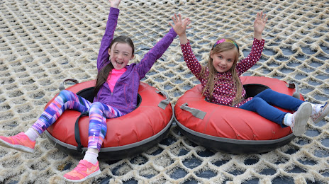
Craigavon Golf & Ski Centre — local attraction, which is located at Turmoyra Ln, Lurgan, Craigavon BT66 6NG, United Kingdom and belongs to the category — leisure centre. Average visitor rating for this place — 4.3 (according to 343 ratings, information from open sources and relevant for 2022).
Exact location — Craigavon Golf & Ski Centre, marked on the map with a red marker.
You can get directions to Craigavon Golf & Ski Centre on the map from your location.
What else is interesting in Craigavon? You can see all the sights if you go to the city page.
Coordinates
Craigavon Golf & Ski Centre, United Kingdom coordinates in decimal format: latitude — 54.47505040989517, longitude — -6.356762074663865. When converted to degrees, minutes, seconds Craigavon Golf & Ski Centre has the following coordinates: 54°28′30.18 north latitude and -6°21′24.34 east longitude.
Nearby cities
The largest cities that are located nearby:
- Belfast — 36 km
- Dublin
 (Ireland) — 121 km
 - Glasgow — 207 km
- Liverpool — 253 km
- Preston — 254 km
- Edinburgh — 260 km
- Blackburn — 268 km
- Manchester — 295 km
- Cork (Ireland) — 315 km
- Huddersfield — 316 km
- Stoke-on-Trent — 324 km
- Sunderland — 324 km
- Telford — 330 km
- Sheffield — 347 km
- Rotherham — 351 km
- Dudley — 362 km
- West Bromwich — 366 km
- Sutton Coldfield — 372 km
- Birmingham — 374 km
Distance to the capital
Distance to the capital (London) is about — 532 km.