 Staden
Geest-Gerompont-Petit-Rosière
Grote Hut
Sint-Job-in-'t-Goor
Deidenberg
De Pinte
Pussemange
Peruwelz
Barrière de Champlon
Staden
Geest-Gerompont-Petit-Rosière
Grote Hut
Sint-Job-in-'t-Goor
Deidenberg
De Pinte
Pussemange
Peruwelz
Barrière de Champlon
Wijndomein Entre-Deux-Monts on the map, Poperinge, Belgium
Photo
Where is located Wijndomein Entre-Deux-Monts
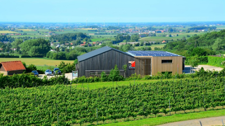
Wijndomein Entre-Deux-Monts — local attraction, which is located at Rodebergstraat 69 A, 8954 Heuvelland, Belgium and belongs to the category — winery. Average visitor rating for this place — 4.5 (according to 89 ratings, information from open sources and relevant for 2022).
Exact location — Wijndomein Entre-Deux-Monts, marked on the map with a red marker.
You can get directions to Wijndomein Entre-Deux-Monts on the map from your location.
What else is interesting in Poperinge? You can see all the sights if you go to the city page.
Coordinates
Wijndomein Entre-Deux-Monts, Belgium coordinates in decimal format: latitude — 50.784709063748714, longitude — 2.7523556251983616. When converted to degrees, minutes, seconds Wijndomein Entre-Deux-Monts has the following coordinates: 50°47′4.95 north latitude and 2°45′8.48 east longitude.
Nearby cities
The largest cities that are located nearby:
- Lille
 (France) — 34 km
 - Amiens (France) — 111 km
- Antwerp — 123 km
- Charleroi — 131 km
- Namur — 157 km
- Southend-on-Sea
 (United Kingdom) — 158 km
 - Gillingham (United Kingdom) — 161 km
- Breda
 (Netherlands) — 162 km
 - Rotterdam (Netherlands) — 168 km
- Eastbourne (United Kingdom) — 171 km
- Ipswich (United Kingdom) — 171 km
- Dordrecht (Netherlands) — 171 km
- The Hague (Netherlands) — 172 km
- Basildon (United Kingdom) — 173 km
- Zoetermeer (Netherlands) — 179 km
- Tilburg (Netherlands) — 180 km
- Chelmsford (United Kingdom) — 183 km
- Leiden (Netherlands) — 188 km
- Rouen (France) — 195 km
Distance to the capital
Distance to the capital (Brussels) is about — 113 km.