 Betteshanger
Lynton
Amesbury
Marlow
Burford
Chipping Norton
Marlborough
Cairnryan
Lydney
Betteshanger
Lynton
Amesbury
Marlow
Burford
Chipping Norton
Marlborough
Cairnryan
Lydney
Whitstable Community Museum & Gallery on the map, Whitstable, United Kingdom
Photo
Where is located Whitstable Community Museum & Gallery
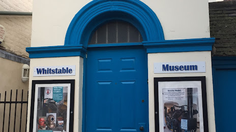
Whitstable Community Museum & Gallery — local attraction, which is located at 5A Oxford St, Whitstable CT5 1DB, United Kingdom and belongs to the category — heritage museum. Average visitor rating for this place — 4.6 (according to 98 ratings, information from open sources and relevant for 2022).
Exact location — Whitstable Community Museum & Gallery, marked on the map with a red marker.
You can get directions to Whitstable Community Museum & Gallery on the map from your location.
What else is interesting in Whitstable? You can see all the sights if you go to the city page.
Coordinates
Whitstable Community Museum & Gallery, United Kingdom coordinates in decimal format: latitude — 51.35681658052565, longitude — 1.024596825219295. When converted to degrees, minutes, seconds Whitstable Community Museum & Gallery has the following coordinates: 51°21′24.54 north latitude and 1°1′28.55 east longitude.
Nearby cities
The largest cities that are located nearby:
- Southend-on-Sea — 30 km
- Gillingham — 33 km
- Basildon — 44 km
- Chelmsford — 56 km
- Ipswich — 77 km
- Eastbourne — 83 km
- Sutton — 84 km
- Crawley — 89 km
- Watford — 102 km
- Cambridge — 112 km
- Slough — 113 km
- Luton — 114 km
- Reading — 138 km
- Norwich — 142 km
- Portsmouth — 159 km
- Oxford — 162 km
- Northampton — 163 km
- Lille
 (France) — 164 km
 - Southampton — 177 km
Distance to the capital
Distance to the capital (London) is about — 82 km.