 Betteshanger
Lynton
Amesbury
Marlow
Burford
Chipping Norton
Marlborough
Cairnryan
Lydney
Betteshanger
Lynton
Amesbury
Marlow
Burford
Chipping Norton
Marlborough
Cairnryan
Lydney
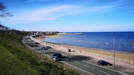
Rhos-on-Sea Beach on the map, Colwyn Bay, United Kingdom
Photo
Where is located Rhos-on-Sea Beach
Rhos-on-Sea Beach — local attraction, which is located at no data and belongs to the category — -. Average visitor rating for this place — 4.6 (according to 1450 ratings, information from open sources and relevant for 2022).
Exact location — Rhos-on-Sea Beach, marked on the map with a red marker.
You can get directions to Rhos-on-Sea Beach on the map from your location.
What else is interesting in Colwyn Bay? You can see all the sights if you go to the city page.
Coordinates
Rhos-on-Sea Beach, United Kingdom coordinates in decimal format: latitude — 53.302500109539984, longitude — -3.7303154791307165. When converted to degrees, minutes, seconds Rhos-on-Sea Beach has the following coordinates: 53°18′9 north latitude and -3°43′49.14 east longitude.
Nearby cities
The largest cities that are located nearby:
- Liverpool — 50 km
- Preston — 85 km
- Blackburn — 95 km
- Manchester — 100 km
- Stoke-on-Trent — 108 km
- Telford — 110 km
- Huddersfield — 133 km
- Dudley — 140 km
- West Bromwich — 145 km
- Sheffield — 149 km
- Sutton Coldfield — 151 km
- Birmingham — 153 km
- Rotherham — 156 km
- Worcester — 159 km
- Dublin
 (Ireland) — 167 km
 - Coventry — 178 km
- Leicester — 188 km
- Cheltenham — 191 km
- Belfast — 202 km
Distance to the capital
Distance to the capital (London) is about — 316 km.