 Betteshanger
Lynton
Amesbury
Marlow
Burford
Chipping Norton
Marlborough
Cairnryan
Lydney
Betteshanger
Lynton
Amesbury
Marlow
Burford
Chipping Norton
Marlborough
Cairnryan
Lydney
St Paul's Church, Colwyn Bay on the map, Colwyn Bay, United Kingdom
Photo
Where is located St Paul's Church, Colwyn Bay
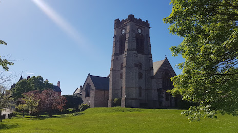
St Paul's Church, Colwyn Bay — local attraction, which is located at 7TE, Conway Rd, Conwy, Colwyn Bay, United Kingdom and belongs to the category — parish church. Average visitor rating for this place — 4.4 (according to 22 ratings, information from open sources and relevant for 2022).
Exact location — St Paul's Church, Colwyn Bay, marked on the map with a red marker.
You can get directions to St Paul's Church, Colwyn Bay on the map from your location.
What else is interesting in Colwyn Bay? You can see all the sights if you go to the city page.
Coordinates
St Paul's Church, Colwyn Bay, United Kingdom coordinates in decimal format: latitude — 53.29360721607088, longitude — -3.7264851747086922. When converted to degrees, minutes, seconds St Paul's Church, Colwyn Bay has the following coordinates: 53°17′36.99 north latitude and -3°43′35.35 east longitude.
Nearby cities
The largest cities that are located nearby:
- Liverpool — 50 km
- Preston — 85 km
- Blackburn — 95 km
- Manchester — 100 km
- Stoke-on-Trent — 108 km
- Telford — 110 km
- Huddersfield — 133 km
- Dudley — 140 km
- West Bromwich — 145 km
- Sheffield — 149 km
- Sutton Coldfield — 151 km
- Birmingham — 153 km
- Rotherham — 156 km
- Worcester — 159 km
- Dublin
 (Ireland) — 167 km
 - Coventry — 178 km
- Leicester — 188 km
- Cheltenham — 191 km
- Belfast — 202 km
Distance to the capital
Distance to the capital (London) is about — 315 km.