 Betteshanger
Lynton
Amesbury
Marlow
Burford
Chipping Norton
Marlborough
Cairnryan
Lydney
Betteshanger
Lynton
Amesbury
Marlow
Burford
Chipping Norton
Marlborough
Cairnryan
Lydney
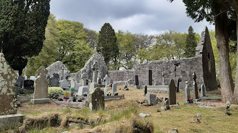
Killeavy Old Churches on the map, Newry, United Kingdom
Photo
Where is located Killeavy Old Churches
Killeavy Old Churches — local attraction, which is located at Church Rd, Killeavy, Newry BT35 8LF, United Kingdom and belongs to the category — historical landmark. Average visitor rating for this place — 4.7 (according to 44 ratings, information from open sources and relevant for 2022).
Exact location — Killeavy Old Churches, marked on the map with a red marker.
You can get directions to Killeavy Old Churches on the map from your location.
What else is interesting in Newry? You can see all the sights if you go to the city page.
Coordinates
Killeavy Old Churches, United Kingdom coordinates in decimal format: latitude — 54.13714995288219, longitude — -6.409394274676734. When converted to degrees, minutes, seconds Killeavy Old Churches has the following coordinates: 54°8′13.74 north latitude and -6°24′33.82 east longitude.
Nearby cities
The largest cities that are located nearby:
- Belfast — 54 km
- Dublin
 (Ireland) — 91 km
 - Glasgow — 227 km
- Liverpool — 236 km
- Preston — 242 km
- Blackburn — 256 km
- Edinburgh — 277 km
- Manchester — 280 km
- Cork (Ireland) — 291 km
- Huddersfield — 304 km
- Stoke-on-Trent — 306 km
- Telford — 309 km
- Sunderland — 325 km
- Sheffield — 333 km
- Rotherham — 338 km
- Dudley — 341 km
- West Bromwich — 345 km
- Sutton Coldfield — 352 km
- Birmingham — 353 km
Distance to the capital
Distance to the capital (London) is about — 513 km.