 Betteshanger
Lynton
Amesbury
Marlow
Burford
Chipping Norton
Marlborough
Cairnryan
Lydney
Betteshanger
Lynton
Amesbury
Marlow
Burford
Chipping Norton
Marlborough
Cairnryan
Lydney
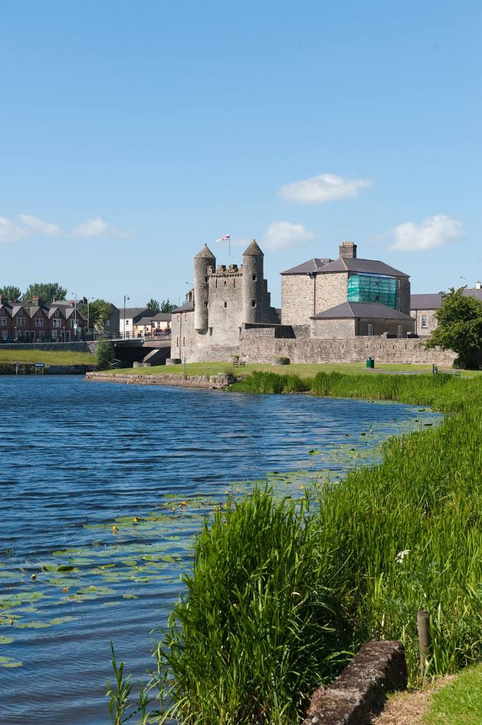
Enniskillen Castle Museums on the map, Enniskillen, United Kingdom
Photo
Where is located Enniskillen Castle Museums
Enniskillen Castle Museums — local attraction, which is located at Enniskillen BT74 7HL, United Kingdom and belongs to the category — museum. Average visitor rating for this place — 4.5 (according to 1007 ratings, information from open sources and relevant for 2022).
Exact location — Enniskillen Castle Museums, marked on the map with a red marker.
You can get directions to Enniskillen Castle Museums on the map from your location.
What else is interesting in Enniskillen? You can see all the sights if you go to the city page.
Coordinates
Enniskillen Castle Museums, United Kingdom coordinates in decimal format: latitude — 54.34635761188048, longitude — -7.644231074668734. When converted to degrees, minutes, seconds Enniskillen Castle Museums has the following coordinates: 54°20′46.89 north latitude and -7°38′39.23 east longitude.
Nearby cities
The largest cities that are located nearby:
- Belfast — 113 km
- Dublin
 (Ireland) — 142 km
 - Glasgow — 269 km
- Cork (Ireland) — 277 km
- Liverpool — 323 km
- Edinburgh — 328 km
- Preston — 328 km
- Blackburn — 343 km
- Manchester — 367 km
- Huddersfield — 391 km
- Stoke-on-Trent — 392 km
- Telford — 393 km
- Sunderland — 402 km
- Sheffield — 420 km
- Dudley — 425 km
- Rotherham — 425 km
- West Bromwich — 430 km
- Sutton Coldfield — 437 km
- Worcester — 437 km
Distance to the capital
Distance to the capital (London) is about — 594 km.