
 Staden
Geest-Gerompont-Petit-Rosière
Grote Hut
Sint-Job-in-'t-Goor
Deidenberg
De Pinte
Pussemange
Peruwelz
Barrière de Champlon
Staden
Geest-Gerompont-Petit-Rosière
Grote Hut
Sint-Job-in-'t-Goor
Deidenberg
De Pinte
Pussemange
Peruwelz
Barrière de Champlon
La Senne on the map, Sint-Pieters-Leeuw, Belgium
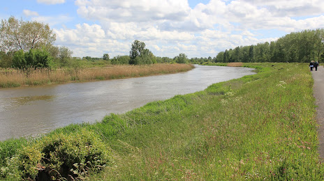
Photo
Where is located La Senne
La Senne — local attraction, which is located at 103 km and belongs to the category — -. Average visitor rating for this place — 3.9 (according to 117 ratings, information from open sources and relevant for 2022).
Exact location — La Senne, marked on the map with a red marker.
You can get directions to La Senne on the map from your location.
What else is interesting in Sint-Pieters-Leeuw? You can see all the sights if you go to the city page.
Coordinates
La Senne, Belgium coordinates in decimal format: latitude — 50.796921183255556, longitude — 4.320918318619434. When converted to degrees, minutes, seconds La Senne has the following coordinates: 50°47′48.92 north latitude and 4°19′15.31 east longitude.
Nearby cities
The largest cities that are located nearby:
- Charleroi — 43 km
- Antwerp — 50 km
- Namur — 56 km
- Lille
 (France) — 85 km
 - Liège — 95 km
- Breda
 (Netherlands) — 96 km
 - Maastricht (Netherlands) — 101 km
- Tilburg (Netherlands) — 104 km
- Eindhoven (Netherlands) — 112 km
- Dordrecht (Netherlands) — 118 km
- 's-Hertogenbosch (Netherlands) — 125 km
- Rotterdam (Netherlands) — 128 km
- Aachen
 (Germany) — 129 km
 - Zoetermeer (Netherlands) — 143 km
- The Hague (Netherlands) — 143 km
- Leiden (Netherlands) — 154 km
- Utrecht (Netherlands) — 157 km
- Nijmegen (Netherlands) — 158 km
- Mönchengladbach (Germany) — 159 km
Distance to the capital
Distance to the capital (Brussels) is about — 6 km.