 Betteshanger
Lynton
Amesbury
Marlow
Burford
Chipping Norton
Marlborough
Cairnryan
Lydney
Betteshanger
Lynton
Amesbury
Marlow
Burford
Chipping Norton
Marlborough
Cairnryan
Lydney
St Peter's Church on the map, Sunderland, United Kingdom
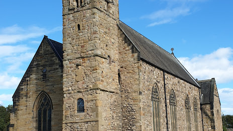
Photo
Where is located St Peter's Church
St Peter's Church — local attraction, which is located at St Peters' Way, Monkwearmouth, Sunderland SR6 0DY, United Kingdom and belongs to the category — parish church. Average visitor rating for this place — 4.7 (according to 123 ratings, information from open sources and relevant for 2022).
Exact location — St Peter's Church, marked on the map with a red marker.
You can get directions to St Peter's Church on the map from your location.
What else is interesting in Sunderland? You can see all the sights if you go to the city page.
Coordinates
St Peter's Church, United Kingdom coordinates in decimal format: latitude — 54.94094742582101, longitude — -1.4463313539496438. When converted to degrees, minutes, seconds St Peter's Church has the following coordinates: 54°56′27.41 north latitude and -1°26′46.79 east longitude.
Nearby cities
The largest cities that are located nearby:
- Huddersfield — 142 km
- Blackburn — 147 km
- Preston — 153 km
- Edinburgh — 161 km
- Rotherham — 163 km
- Manchester — 167 km
- Sheffield — 169 km
- Liverpool — 197 km
- Glasgow — 207 km
- Stoke-on-Trent — 217 km
- Leicester — 252 km
- Telford — 256 km
- Sutton Coldfield — 260 km
- West Bromwich — 267 km
- Dudley — 269 km
- Birmingham — 270 km
- Coventry — 277 km
- Belfast — 293 km
- Northampton — 297 km
Distance to the capital
Distance to the capital (London) is about — 392 km.