 Betteshanger
Lynton
Amesbury
Marlow
Burford
Chipping Norton
Marlborough
Cairnryan
Lydney
Betteshanger
Lynton
Amesbury
Marlow
Burford
Chipping Norton
Marlborough
Cairnryan
Lydney
St Mary & St Cuthbert's Church on the map, Sunderland, United Kingdom
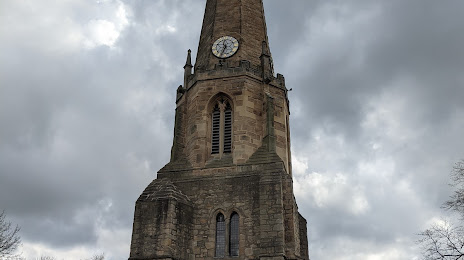
Photo
Where is located St Mary & St Cuthbert's Church
St Mary & St Cuthbert's Church — local attraction, which is located at Parish Centre, Church Chare, Chester-le-Street DH3 3QB, United Kingdom and belongs to the category — building. Average visitor rating for this place — 4.6 (according to 98 ratings, information from open sources and relevant for 2022).
Exact location — St Mary & St Cuthbert's Church, marked on the map with a red marker.
You can get directions to St Mary & St Cuthbert's Church on the map from your location.
What else is interesting in Sunderland? You can see all the sights if you go to the city page.
Coordinates
St Mary & St Cuthbert's Church, United Kingdom coordinates in decimal format: latitude — 54.906511589650755, longitude — -1.4502449246473128. When converted to degrees, minutes, seconds St Mary & St Cuthbert's Church has the following coordinates: 54°54′23.44 north latitude and -1°27′0.88 east longitude.
Nearby cities
The largest cities that are located nearby:
- Huddersfield — 142 km
- Blackburn — 147 km
- Preston — 153 km
- Edinburgh — 161 km
- Rotherham — 163 km
- Manchester — 167 km
- Sheffield — 169 km
- Liverpool — 197 km
- Glasgow — 207 km
- Stoke-on-Trent — 217 km
- Leicester — 252 km
- Telford — 256 km
- Sutton Coldfield — 260 km
- West Bromwich — 267 km
- Dudley — 269 km
- Birmingham — 270 km
- Coventry — 277 km
- Belfast — 293 km
- Northampton — 297 km
Distance to the capital
Distance to the capital (London) is about — 388 km.