 Betteshanger
Lynton
Amesbury
Marlow
Burford
Chipping Norton
Marlborough
Cairnryan
Lydney
Betteshanger
Lynton
Amesbury
Marlow
Burford
Chipping Norton
Marlborough
Cairnryan
Lydney
Mynydd y Gaer on the map, Aberkenfig, United Kingdom
Photo
Where is located Mynydd y Gaer
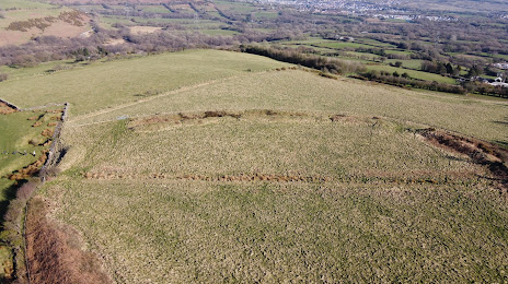
Mynydd y Gaer — local attraction, which is located at 295 m and belongs to the category — -. Average visitor rating for this place — 4.9 (according to 8 ratings, information from open sources and relevant for 2022).
Exact location — Mynydd y Gaer, marked on the map with a red marker.
You can get directions to Mynydd y Gaer on the map from your location.
What else is interesting in Aberkenfig? You can see all the sights if you go to the city page.
Coordinates
Mynydd y Gaer, United Kingdom coordinates in decimal format: latitude — 51.56145808334736, longitude — -3.511315090854452. When converted to degrees, minutes, seconds Mynydd y Gaer has the following coordinates: 51°33′41.25 north latitude and -3°30′40.73 east longitude.
Nearby cities
The largest cities that are located nearby:
- Bristol — 70 km
- Exeter — 91 km
- Cheltenham — 111 km
- Worcester — 118 km
- Swindon — 125 km
- Telford — 148 km
- Dudley — 148 km
- Bournemouth — 151 km
- West Bromwich — 153 km
- Birmingham — 155 km
- Oxford — 162 km
- Sutton Coldfield — 165 km
- Southampton — 168 km
- Coventry — 170 km
- Reading — 181 km
- Stoke-on-Trent — 187 km
- Portsmouth — 193 km
- Northampton — 198 km
- Leicester — 205 km
Distance to the capital
Distance to the capital (London) is about — 234 km.