 Betteshanger
Lynton
Amesbury
Marlow
Burford
Chipping Norton
Marlborough
Cairnryan
Lydney
Betteshanger
Lynton
Amesbury
Marlow
Burford
Chipping Norton
Marlborough
Cairnryan
Lydney
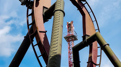
Nemesis Inferno on the map, Walton-on-Thames, United Kingdom
Photo
Where is located Nemesis Inferno
Nemesis Inferno — local attraction, which is located at Staines Rd, Chertsey KT16 8PN, United Kingdom and belongs to the category — roller coaster. Average visitor rating for this place — 4.7 (according to 1081 rating, information from open sources and relevant for 2022).
Exact location — Nemesis Inferno, marked on the map with a red marker.
You can get directions to Nemesis Inferno on the map from your location.
What else is interesting in Walton-on-Thames? You can see all the sights if you go to the city page.
Coordinates
Nemesis Inferno, United Kingdom coordinates in decimal format: latitude — 51.403569461220734, longitude — -0.5160237746843958. When converted to degrees, minutes, seconds Nemesis Inferno has the following coordinates: 51°24′12.85 north latitude and -0°30′57.69 east longitude.
Nearby cities
The largest cities that are located nearby:
- Sutton — 16 km
- Slough — 18 km
- Watford — 30 km
- Crawley — 35 km
- Reading — 39 km
- Luton — 54 km
- Basildon — 66 km
- Gillingham — 67 km
- Oxford — 70 km
- Chelmsford — 72 km
- Portsmouth — 78 km
- Southend-on-Sea — 79 km
- Eastbourne — 85 km
- Southampton — 87 km
- Swindon — 95 km
- Cambridge — 97 km
- Northampton — 100 km
- Bournemouth — 126 km
- Cheltenham — 127 km
Distance to the capital
Distance to the capital (London) is about — 29 km.