 Betteshanger
Lynton
Amesbury
Marlow
Burford
Chipping Norton
Marlborough
Cairnryan
Lydney
Betteshanger
Lynton
Amesbury
Marlow
Burford
Chipping Norton
Marlborough
Cairnryan
Lydney
Burncrooks Reservoir on the map, Clydebank, United Kingdom
Photo
Where is located Burncrooks Reservoir
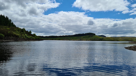
Burncrooks Reservoir — local attraction, which is located at no data and belongs to the category — -. Average visitor rating for this place — 4.5 (according to 25 ratings, information from open sources and relevant for 2022).
Exact location — Burncrooks Reservoir, marked on the map with a red marker.
You can get directions to Burncrooks Reservoir on the map from your location.
What else is interesting in Clydebank? You can see all the sights if you go to the city page.
Coordinates
Burncrooks Reservoir, United Kingdom coordinates in decimal format: latitude — 55.981333347036966, longitude — -4.428920666070419. When converted to degrees, minutes, seconds Burncrooks Reservoir has the following coordinates: 55°58′52.8 north latitude and -4°25′44.11 east longitude.
Nearby cities
The largest cities that are located nearby:
- Glasgow — 10 km
- Edinburgh — 76 km
- Belfast — 174 km
- Sunderland — 221 km
- Preston — 261 km
- Blackburn — 269 km
- Liverpool — 291 km
- Huddersfield — 303 km
- Manchester — 303 km
- Dublin
 (Ireland) — 307 km
 - Rotherham — 338 km
- Sheffield — 339 km
- Stoke-on-Trent — 353 km
- Telford — 380 km
- Dudley — 406 km
- Sutton Coldfield — 407 km
- West Bromwich — 408 km
- Birmingham — 414 km
- Leicester — 422 km
Distance to the capital
Distance to the capital (London) is about — 572 km.