
 Staden
Geest-Gerompont-Petit-Rosière
Grote Hut
Sint-Job-in-'t-Goor
Deidenberg
De Pinte
Pussemange
Peruwelz
Barrière de Champlon
Staden
Geest-Gerompont-Petit-Rosière
Grote Hut
Sint-Job-in-'t-Goor
Deidenberg
De Pinte
Pussemange
Peruwelz
Barrière de Champlon
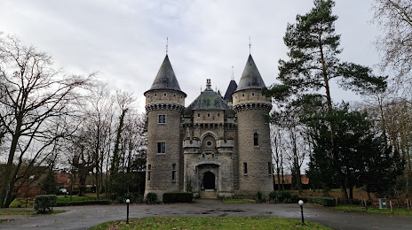
Kasteel van Zellaer on the map, Sint-Katelijne-Waver, Belgium
Photo
Where is located Kasteel van Zellaer
Kasteel van Zellaer — local attraction, which is located at Zellaerdreef 1, 2820 Bonheiden, Belgium and belongs to the category — castle. Average visitor rating for this place — 4.3 (according to 287 ratings, information from open sources and relevant for 2022).
Exact location — Kasteel van Zellaer, marked on the map with a red marker.
You can get directions to Kasteel van Zellaer on the map from your location.
What else is interesting in Sint-Katelijne-Waver? You can see all the sights if you go to the city page.
Coordinates
Kasteel van Zellaer, Belgium coordinates in decimal format: latitude — 51.03336531798634, longitude — 4.53785222530202. When converted to degrees, minutes, seconds Kasteel van Zellaer has the following coordinates: 51°2′0.12 north latitude and 4°32′16.27 east longitude.
Nearby cities
The largest cities that are located nearby:
- Antwerp — 19 km
- Breda
 (Netherlands) — 59 km
 - Tilburg (Netherlands) — 66 km
- Namur — 71 km
- Charleroi — 73 km
- Eindhoven (Netherlands) — 77 km
- Dordrecht (Netherlands) — 83 km
- Maastricht (Netherlands) — 84 km
- 's-Hertogenbosch (Netherlands) — 87 km
- Liège — 88 km
- Rotterdam (Netherlands) — 94 km
- Zoetermeer (Netherlands) — 110 km
- The Hague (Netherlands) — 112 km
- Aachen
 (Germany) — 113 km
 - Lille
 (France) — 114 km
 - Utrecht (Netherlands) — 120 km
- Leiden (Netherlands) — 120 km
- Nijmegen (Netherlands) — 121 km
- Ede (Netherlands) — 132 km
Distance to the capital
Distance to the capital (Brussels) is about — 24 km.