
 Staden
Geest-Gerompont-Petit-Rosière
Grote Hut
Sint-Job-in-'t-Goor
Deidenberg
De Pinte
Pussemange
Peruwelz
Barrière de Champlon
Staden
Geest-Gerompont-Petit-Rosière
Grote Hut
Sint-Job-in-'t-Goor
Deidenberg
De Pinte
Pussemange
Peruwelz
Barrière de Champlon
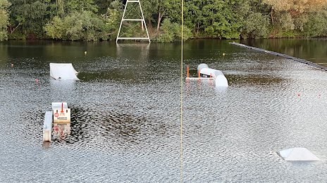
Wake-Up Cable Gent on the map, Destelbergen, Belgium
Photo
Where is located Wake-Up Cable Gent
Wake-Up Cable Gent — local attraction, which is located at Stapsteenweg 50, 9070 Destelbergen, Belgium and belongs to the category — sports complex. Average visitor rating for this place — 4.7 (according to 31 rating, information from open sources and relevant for 2022).
Exact location — Wake-Up Cable Gent, marked on the map with a red marker.
You can get directions to Wake-Up Cable Gent on the map from your location.
What else is interesting in Destelbergen? You can see all the sights if you go to the city page.
Coordinates
Wake-Up Cable Gent, Belgium coordinates in decimal format: latitude — 51.045525653334096, longitude — 3.8071594252078795. When converted to degrees, minutes, seconds Wake-Up Cable Gent has the following coordinates: 51°2′43.89 north latitude and 3°48′25.77 east longitude.
Nearby cities
The largest cities that are located nearby:
- Antwerp — 45 km
- Lille
 (France) — 71 km
 - Charleroi — 85 km
- Breda
 (Netherlands) — 89 km
 - Namur — 100 km
- Dordrecht (Netherlands) — 103 km
- Tilburg (Netherlands) — 105 km
- Rotterdam (Netherlands) — 106 km
- The Hague (Netherlands) — 117 km
- Zoetermeer (Netherlands) — 120 km
- Eindhoven (Netherlands) — 123 km
- 's-Hertogenbosch (Netherlands) — 125 km
- Leiden (Netherlands) — 130 km
- Liège — 134 km
- Maastricht (Netherlands) — 134 km
- Utrecht (Netherlands) — 145 km
- Hoofddorp (Netherlands) — 150 km
- Haarlem (Netherlands) — 157 km
- Amersfoort (Netherlands) — 162 km
Distance to the capital
Distance to the capital (Brussels) is about — 44 km.