 Betteshanger
Lynton
Amesbury
Marlow
Burford
Chipping Norton
Marlborough
Cairnryan
Lydney
Betteshanger
Lynton
Amesbury
Marlow
Burford
Chipping Norton
Marlborough
Cairnryan
Lydney
Pettycur Beach on the map, Kirkcaldy, United Kingdom
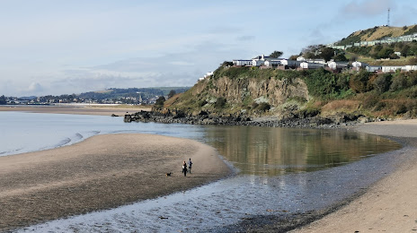
Photo
Where is located Pettycur Beach
Pettycur Beach — local attraction, which is located at no data and belongs to the category — -. Average visitor rating for this place — 4.6 (according to 474 ratings, information from open sources and relevant for 2022).
Exact location — Pettycur Beach, marked on the map with a red marker.
You can get directions to Pettycur Beach on the map from your location.
What else is interesting in Kirkcaldy? You can see all the sights if you go to the city page.
Coordinates
Pettycur Beach, United Kingdom coordinates in decimal format: latitude — 56.06299627330655, longitude — -3.1848228806355974. When converted to degrees, minutes, seconds Pettycur Beach has the following coordinates: 56°3′46.79 north latitude and -3°11′5.36 east longitude.
Nearby cities
The largest cities that are located nearby:
- Edinburgh — 18 km
- Glasgow — 73 km
- Sunderland — 175 km
- Belfast — 244 km
- Preston — 262 km
- Blackburn — 265 km
- Huddersfield — 288 km
- Manchester — 298 km
- Liverpool — 300 km
- Rotherham — 319 km
- Sheffield — 322 km
- Stoke-on-Trent — 350 km
- Dublin
 (Ireland) — 368 km
 - Telford — 383 km
- Sutton Coldfield — 402 km
- Dudley — 405 km
- West Bromwich — 406 km
- Leicester — 408 km
- Birmingham — 410 km
Distance to the capital
Distance to the capital (London) is about — 545 km.