 Betteshanger
Lynton
Amesbury
Marlow
Burford
Chipping Norton
Marlborough
Cairnryan
Lydney
Betteshanger
Lynton
Amesbury
Marlow
Burford
Chipping Norton
Marlborough
Cairnryan
Lydney
Foulden Hagg Caravans on the map, Berwick-upon-Tweed, United Kingdom
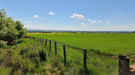
Photo
Where is located Foulden Hagg Caravans
Foulden Hagg Caravans — local attraction, which is located at Unnamed Road, Berwick-upon-Tweed TD15 1UH, United Kingdom and belongs to the category — tourist attraction. Average visitor rating for this place — 5.0 (according to 2 ratings, information from open sources and relevant for 2022).
Exact location — Foulden Hagg Caravans, marked on the map with a red marker.
You can get directions to Foulden Hagg Caravans on the map from your location.
What else is interesting in Berwick-upon-Tweed? You can see all the sights if you go to the city page.
Coordinates
Foulden Hagg Caravans, United Kingdom coordinates in decimal format: latitude — 55.804635046555816, longitude — -2.1265207745180383. When converted to degrees, minutes, seconds Foulden Hagg Caravans has the following coordinates: 55°48′16.69 north latitude and -2°7′35.47 east longitude.
Nearby cities
The largest cities that are located nearby:
- Edinburgh — 76 km
- Sunderland — 103 km
- Glasgow — 140 km
- Blackburn — 226 km
- Preston — 227 km
- Huddersfield — 235 km
- Manchester — 254 km
- Rotherham — 262 km
- Sheffield — 266 km
- Liverpool — 269 km
- Belfast — 283 km
- Stoke-on-Trent — 306 km
- Telford — 343 km
- Leicester — 351 km
- Sutton Coldfield — 354 km
- West Bromwich — 360 km
- Dudley — 360 km
- Birmingham — 363 km
- Coventry — 373 km
Distance to the capital
Distance to the capital (London) is about — 496 km.