 Betteshanger
Lynton
Amesbury
Marlow
Burford
Chipping Norton
Marlborough
Cairnryan
Lydney
Betteshanger
Lynton
Amesbury
Marlow
Burford
Chipping Norton
Marlborough
Cairnryan
Lydney
Braxton Gardens on the map, Lymington, United Kingdom
Photo
Where is located Braxton Gardens
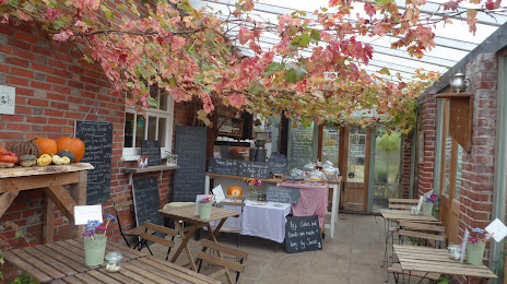
Braxton Gardens — local attraction, which is located at Lymore La, Lymington SO41 0TX, United Kingdom and belongs to the category — tea house. Average visitor rating for this place — 4.3 (according to 77 ratings, information from open sources and relevant for 2022).
Exact location — Braxton Gardens, marked on the map with a red marker.
You can get directions to Braxton Gardens on the map from your location.
What else is interesting in Lymington? You can see all the sights if you go to the city page.
Coordinates
Braxton Gardens, United Kingdom coordinates in decimal format: latitude — 50.74006532618181, longitude — -1.5863117747086617. When converted to degrees, minutes, seconds Braxton Gardens has the following coordinates: 50°44′24.24 north latitude and -1°35′10.72 east longitude.
Nearby cities
The largest cities that are located nearby:
- Southampton — 19 km
- Bournemouth — 24 km
- Portsmouth — 32 km
- Reading — 86 km
- Swindon — 90 km
- Crawley — 102 km
- Bristol — 105 km
- Slough — 106 km
- Oxford — 112 km
- Sutton — 114 km
- Watford — 127 km
- Eastbourne — 128 km
- Cheltenham — 131 km
- Exeter — 140 km
- Luton — 146 km
- Gillingham — 160 km
- Worcester — 165 km
- Basildon — 166 km
- Northampton — 169 km
Distance to the capital
Distance to the capital (London) is about — 133 km.