
Other locations
Judea and Samaria Area  Abou Sultan
Duma
Siris
Hinanit
Qarawat Bani Zeid
Kafr Qaddum
Biddya
Abou Sultan
Duma
Siris
Hinanit
Qarawat Bani Zeid
Kafr Qaddum
Biddya
Mount Ebal on the map, Nablus, Palestinian Territory
Comments
Where is located Mount Ebal on the map, Nablus, Palestinian Territory. Geographic coordinates in decimal format, as well as degrees, minutes and seconds. Photo, address and average rating of visitors who have been here.
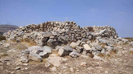
Photo
Where is located Mount Ebal
Mount Ebal — local attraction, which is located at 940 m and belongs to the category — -. Average visitor rating for this place — 4.8 (according to 36 ratings, information from open sources and relevant for 2022).
Exact location — Mount Ebal, marked on the map with a red marker.
You can get directions to Mount Ebal on the map from your location.
What else is interesting in Nablus? You can see all the sights if you go to the city page.
Coordinates
Mount Ebal, Palestinian Territory coordinates in decimal format: latitude — 32.235190887419044, longitude — 35.26944425281491. When converted to degrees, minutes, seconds Mount Ebal has the following coordinates: 32°14′6.69 north latitude and 35°16′10 east longitude.
Nearby cities
The largest cities that are located nearby:
- Netanya
 (Israel) — 40 km
 - Ramat Gan (Israel) — 44 km
- Tel Aviv-Yafo (Israel) — 47 km
- Jerusalem (Israel) — 51 km
- Bat Yam (Israel) — 53 km
- Irbid
 (Jordan) — 66 km
 - Haifa (Israel) — 68 km
- Amman (Jordan) — 71 km
- Ashdod (Israel) — 73 km
- Ashqelon (Israel) — 89 km
- Tyre
 (Lebanon) — 116 km
 - Damascus
 (Syria) — 171 km
 - Duma (Syria) — 182 km
- Beirut (Lebanon) — 185 km
- Tripoli (Lebanon) — 250 km
- Port Said
 (Egypt) — 299 km
 - Ismailia (Egypt) — 337 km
- Limassol
 (Cyprus) — 342 km
 - Hamah (Syria) — 349 km