Allhaming — Perchau am Sattel
Allhaming — Hasreith
Allhaming — Kleinwaging
Allhaming — Mistelbach
Allhaming — Pettneu am Arlberg
Allhaming — Sankt Johann
Allhaming — Loipersdorf im Burgenland
Allhaming — Bürs
Allhaming — Oberhof Sonnseite
Allhaming — Zimmermoos
Allhaming — Bichling
Allhaming — Kerschenberg
Allhaming — Mitterndorf an der Fischa
Allhaming — Feffernitz
Allhaming — Geisberg
Allhaming — Heimschuh
Allhaming — Oberau
Allhaming — Neudegg
Allhaming — Nestelberg
Weyerbach
Sipbachzell
Giering
Sattledt
Maidorf
Oberaustall
Littring
Eberstalzell
Upper Austria
Mühltal
Vorchdorf
Feldham
Unterhörbach
Lindach
Roitham
Hildprechting
Sternberg
Rittham
Kleinreith
Pinsdorf
Gmunden
Altmünster
Ebenzweier
Nachdemsee
Traunkirchen
Trauneck
Ebensee
Plankau
Lahnstein
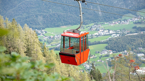
Allhaming — Bad Ischl distance, route on the map
Distance by car
Distance between Allhaming, Upper Austria, Austria and Bad Ischl, Upper Austria, Austria by car is — km, or miles. To travel this distance by car, you need minute, or h.
Route on the map, driving directions
Car route Allhaming — Bad Ischl was created automatically. The road on the map is shown as a blue line. By moving the markers, you can create a new route through the points you need.
Passing cities through which the car route passes: Grassing, Weyerbach, Sipbachzell, Giering, Sattledt, Maidorf, Oberaustall, Littring, Eberstalzell, Upper Austria, Mühltal, Vorchdorf, Feldham, Unterhörbach, Lindach, Roitham, Hildprechting, Sternberg, Rittham, Kleinreith, Pinsdorf, Gmunden, Altmünster, Ebenzweier, Nachdemsee, Traunkirchen, Trauneck, Ebensee, Plankau, Lahnstein.
Distance by plane
If you decide to take a trip Allhaming Bad Ischl by plane, then you have to fly the distance — 64 km or 40 miles. It is marked on the map with a gray line (between two points in a straight line).
Flight time
Estimated flight time Allhaming Bad Ischl by plane at cruising speed 750 km / h will be — 5 min.
Direction of movement
Austria, Allhaming — right-hand traffic. Austria, Bad Ischl — right-hand traffic.
Difference in time
Allhaming and Bad Ischl are in the same time zone. Between them there is no time difference (UTC +2 Europe/Vienna).
Interesting Facts
Information on alternative ways to get to your destination.
The length of this distance is about 0.2% of the total length of the equator.
The cost of travel
Calculate the cost of the trip yourself using the fuel consumption calculator, changing the data in the table.