Westminster — Luthersburg
Westminster — Magna
Westminster — Merrifield
Westminster — Moorcroft
Westminster — Richmond
Westminster — New Waterford
Westminster — Hardtner
Westminster — Encino
Westminster — Greeleyville
Westminster — McComb
Westminster — Wixom
Westminster — Point Pleasant
Westminster — Winneconne
Westminster — Guttenberg
Westminster — Uvalda
Westminster — Washington
Westminster — Locust Gap
Westminster — Larned
Westminster — Moses
Orange
Placentia
Yorba Linda
Yorba Linda
Corona
Norco
Riverside County
Riverside
Moreno Valley
Calimesa
Cherry Valley
Banning
Cabazon
North Palm Springs
Palm Springs
Thousand Palms
Indian Wells
Indio
Thermal
Cactus City
Blythe
Ehrenberg
Quartzsite
Buckeye
Goodyear
Avondale
Tolleson
Phoenix
Phoenix
Phoenix Sky Harbor International Airport
Tempe
Casa Blanca
Sacaton
Casa Grande
Arizona City
Eloy
Picacho
Marana
Tucson
Tucson International Airport
Benson
Dragoon
Cochise
Willcox
Raso
Lordsburg
Moon
Deming
Mesilla
Vado
Berino
Canutillo
Santa Teresa
El Paso
El Paso
Ciudad Juarez
Westminster — Luthersburg
Westminster — Magna
Westminster — Merrifield
Westminster — Moorcroft
Westminster — Richmond
Westminster — New Waterford
Westminster — Hardtner
Westminster — Encino
Westminster — Greeleyville
Westminster — McComb
Westminster — Wixom
Westminster — Point Pleasant
Westminster — Winneconne
Westminster — Guttenberg
Westminster — Uvalda
Westminster — Washington
Westminster — Locust Gap
Westminster — Larned
Westminster — Moses
Orange
Placentia
Yorba Linda
Yorba Linda
Corona
Norco
Riverside County
Riverside
Moreno Valley
Calimesa
Cherry Valley
Banning
Cabazon
North Palm Springs
Palm Springs
Thousand Palms
Indian Wells
Indio
Thermal
Cactus City
Blythe
Ehrenberg
Quartzsite
Buckeye
Goodyear
Avondale
Tolleson
Phoenix
Phoenix
Phoenix Sky Harbor International Airport
Tempe
Casa Blanca
Sacaton
Casa Grande
Arizona City
Eloy
Picacho
Marana
Tucson
Tucson International Airport
Benson
Dragoon
Cochise
Willcox
Raso
Lordsburg
Moon
Deming
Mesilla
Vado
Berino
Canutillo
Santa Teresa
El Paso
El Paso
Ciudad Juarez  El Paso
Border
El Paso
Zaragoza
Clint
Fabens
Fort Hancock
Sierra Blanca
Allamoore
Van Horn
Fort Stockton
Ozona
Sonora
Kerrville
Comfort
Waring
Boerne
Twin-Oaks Airport
San Antonio
Schertz
Cibolo
McQueeney
Seguin
Guadalupe County
Kingsbury
Luling
Waelder
Flatonia
Schulenburg
Weimar
Sealy
San Felipe
Pattison
Brookshire
Katy
Houston
Houston
Harris County
Galena Park
South Houston
Friendswood
Webster
League City
Dickinson
Hitchcock
La Marque
El Paso
Border
El Paso
Zaragoza
Clint
Fabens
Fort Hancock
Sierra Blanca
Allamoore
Van Horn
Fort Stockton
Ozona
Sonora
Kerrville
Comfort
Waring
Boerne
Twin-Oaks Airport
San Antonio
Schertz
Cibolo
McQueeney
Seguin
Guadalupe County
Kingsbury
Luling
Waelder
Flatonia
Schulenburg
Weimar
Sealy
San Felipe
Pattison
Brookshire
Katy
Houston
Houston
Harris County
Galena Park
South Houston
Friendswood
Webster
League City
Dickinson
Hitchcock
La Marque
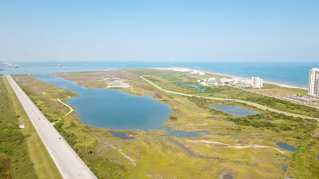
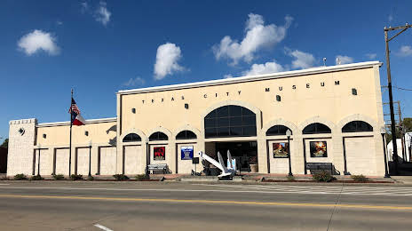
Westminster — Texas City distance, route on the map
Distance by car
Distance between Westminster, California, United States and Texas City, Texas, United States by car is — km, or miles. To travel this distance by car, you need minute, or h.
Route on the map, driving directions
Car route Westminster — Texas City was created automatically. The road on the map is shown as a blue line. By moving the markers, you can create a new route through the points you need.
Passing cities through which the car route passes: Garden Grove, Orange, Placentia, Yorba Linda, Yorba Linda, Corona, Norco, Riverside County, Riverside, Moreno Valley, Calimesa, Cherry Valley, Banning, Cabazon, North Palm Springs, Palm Springs, Thousand Palms, Indian Wells, Indio, Thermal, Cactus City, Blythe, Ehrenberg, Quartzsite, Buckeye, Goodyear, Avondale, Tolleson, Phoenix, Phoenix, Phoenix Sky Harbor International Airport, Tempe, Casa Blanca, Sacaton, Casa Grande, Arizona City, Eloy, Picacho, Marana, Tucson, Tucson International Airport, Benson, Dragoon, Cochise, Willcox, Raso, Lordsburg, Moon, Deming, Mesilla, Vado, Berino, Canutillo, Santa Teresa, El Paso, El Paso, Ciudad Juarez (mx), El Paso, Border (mx), El Paso, Zaragoza (mx), Clint, Fabens, Fort Hancock, Sierra Blanca, Allamoore, Van Horn, Fort Stockton, Ozona, Sonora, Kerrville, Comfort, Waring, Boerne, Twin-Oaks Airport, San Antonio, Schertz, Cibolo, McQueeney, Seguin, Guadalupe County, Kingsbury, Luling, Waelder, Flatonia, Schulenburg, Weimar, Sealy, San Felipe, Pattison, Brookshire, Katy, Houston, Houston, Harris County, Galena Park, South Houston, Friendswood, Webster, League City, Dickinson, Hitchcock, La Marque.
Distance by plane
If you decide to take a trip Westminster Texas City by plane, then you have to fly the distance — 2236 km or 1386 miles. It is marked on the map with a gray line (between two points in a straight line).
Flight time
Estimated flight time Westminster Texas City by plane at cruising speed 750 km / h will be — 2 h. and 58 min.
Direction of movement
United States, Westminster — right-hand traffic. United States, Texas City — right-hand traffic.
Difference in time
Westminster and Texas City are in different time zones. The time difference is 2 hours (UTC -7 America/Los_Angeles, UTC -5 America/Chicago).
Interesting Facts
Information on alternative ways to get to your destination.
The length of this distance is about 5.6% of the total length of the equator.
The percentage of the population is clearly shown in the graph:
Westminster — 89,701, Texas City — 43,879 residents (less by 45,822).
The cost of travel
Calculate the cost of the trip yourself using the fuel consumption calculator, changing the data in the table.