
 Staden
Geest-Gerompont-Petit-Rosière
Grote Hut
Sint-Job-in-'t-Goor
Deidenberg
De Pinte
Pussemange
Peruwelz
Barrière de Champlon
Staden
Geest-Gerompont-Petit-Rosière
Grote Hut
Sint-Job-in-'t-Goor
Deidenberg
De Pinte
Pussemange
Peruwelz
Barrière de Champlon
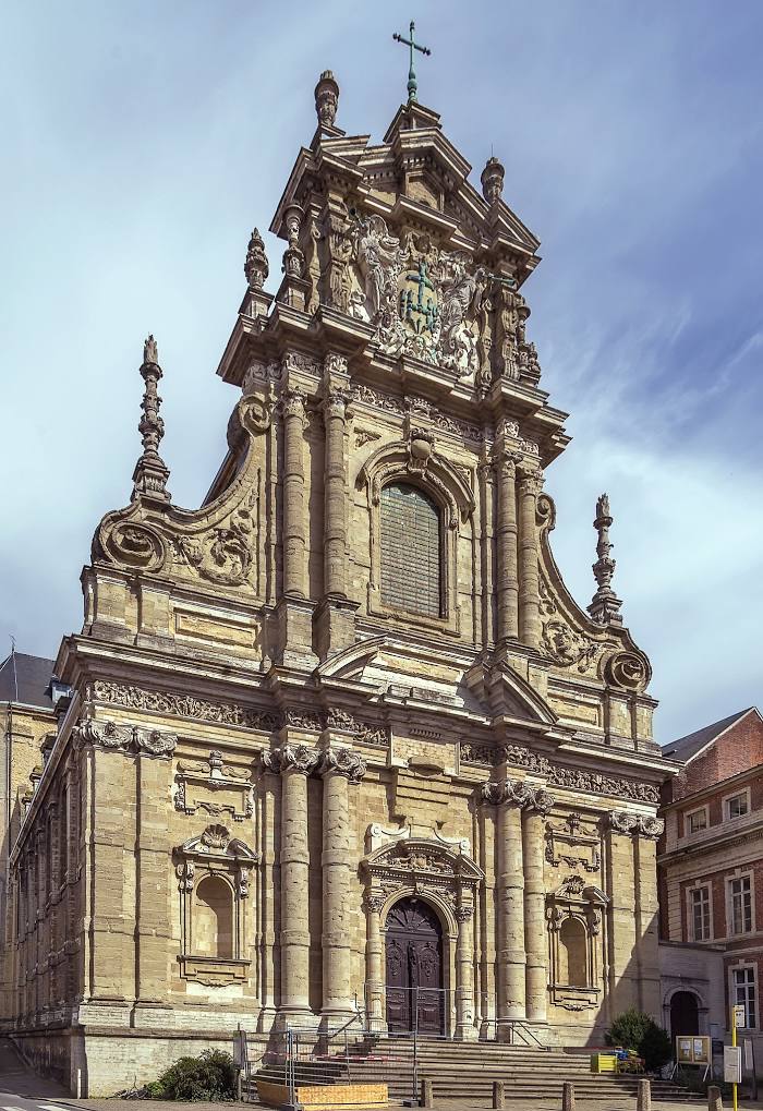
Saint Michael's Church (Sint-Michielskerk) on the map, Leuven, Belgium
Photo
Where is located Saint Michael's Church (Sint-Michielskerk)
Saint Michael's Church (Sint-Michielskerk) — local attraction, which is located at Naamsestraat 57a, 3000 Leuven, Belgium and belongs to the category — church. Average visitor rating for this place — 4.4 (according to 136 ratings, information from open sources and relevant for 2022).
Exact location — Saint Michael's Church (Sint-Michielskerk), marked on the map with a red marker.
You can get directions to Saint Michael's Church (Sint-Michielskerk) on the map from your location.
What else is interesting in Leuven? You can see all the sights if you go to the city page.
Coordinates
Saint Michael's Church (Sint-Michielskerk), Belgium coordinates in decimal format: latitude — 50.87637707127024, longitude — 4.7007529982717875. When converted to degrees, minutes, seconds Saint Michael's Church (Sint-Michielskerk) has the following coordinates: 50°52′34.96 north latitude and 4°42′2.71 east longitude.
Nearby cities
The largest cities that are located nearby:
- Antwerp — 42 km
- Namur — 48 km
- Charleroi — 55 km
- Liège — 68 km
- Maastricht
 (Netherlands) — 69 km
 - Breda (Netherlands) — 78 km
- Tilburg (Netherlands) — 80 km
- Eindhoven (Netherlands) — 81 km
- Aachen
 (Germany) — 97 km
 - 's-Hertogenbosch (Netherlands) — 99 km
- Dordrecht (Netherlands) — 103 km
- Rotterdam (Netherlands) — 116 km
- Lille
 (France) — 119 km
 - Mönchengladbach (Germany) — 125 km
- Nijmegen (Netherlands) — 129 km
- Zoetermeer (Netherlands) — 131 km
- The Hague (Netherlands) — 134 km
- Utrecht (Netherlands) — 137 km
- Krefeld (Germany) — 140 km
Distance to the capital
Distance to the capital (Brussels) is about — 25 km.