
 Staden
Geest-Gerompont-Petit-Rosière
Grote Hut
Sint-Job-in-'t-Goor
Deidenberg
De Pinte
Pussemange
Peruwelz
Barrière de Champlon
Staden
Geest-Gerompont-Petit-Rosière
Grote Hut
Sint-Job-in-'t-Goor
Deidenberg
De Pinte
Pussemange
Peruwelz
Barrière de Champlon
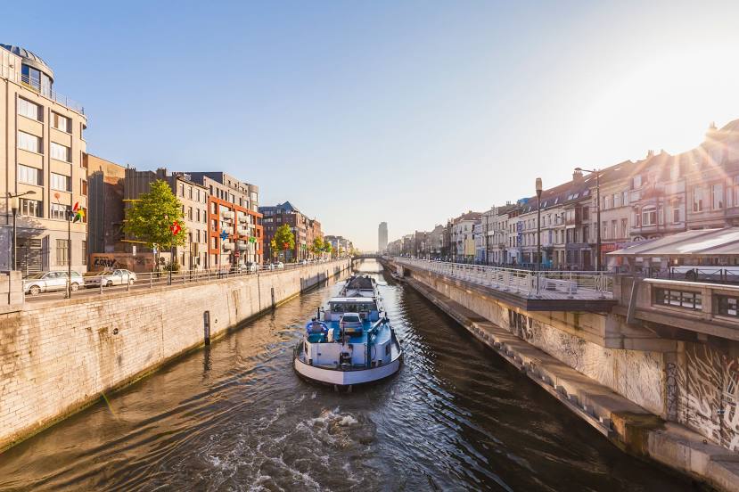
Brussels-Charleroi Canal on the map, Charleroi, Belgium
Photo
Where is located Brussels-Charleroi Canal
Brussels-Charleroi Canal — local attraction, which is located at 1827 and belongs to the category — -. Average visitor rating for this place — 4.3 (according to 123 ratings, information from open sources and relevant for 2022).
Exact location — Brussels-Charleroi Canal, marked on the map with a red marker.
You can get directions to Brussels-Charleroi Canal on the map from your location.
What else is interesting in Charleroi? You can see all the sights if you go to the city page.
Coordinates
Brussels-Charleroi Canal, Belgium coordinates in decimal format: latitude — 50.629113592347196, longitude — 4.359331705014968. When converted to degrees, minutes, seconds Brussels-Charleroi Canal has the following coordinates: 50°37′44.81 north latitude and 4°21′33.59 east longitude.
Nearby cities
The largest cities that are located nearby:
- Namur — 31 km
- Liège — 83 km
- Antwerp — 89 km
- Maastricht
 (Netherlands) — 100 km
 - Lille
 (France) — 100 km
 - Aachen
 (Germany) — 121 km
 - Reims (France) — 131 km
- Breda (Netherlands) — 132 km
- Eindhoven (Netherlands) — 134 km
- Tilburg (Netherlands) — 135 km
- 's-Hertogenbosch (Netherlands) — 154 km
- Dordrecht (Netherlands) — 156 km
- Mönchengladbach (Germany) — 163 km
- Amiens (France) — 163 km
- Rotterdam (Netherlands) — 167 km
- Trier (Germany) — 173 km
- Neuss (Germany) — 178 km
- Krefeld (Germany) — 180 km
- Nijmegen (Netherlands) — 182 km
Distance to the capital
Distance to the capital (Brussels) is about — 25 km.