
 Pointe-à-la-Croix
Sainte-Irène, Quebec
Marsoui
Hecla
Muskrat Dam
Wunnummin Lake
Sainte-Brigitte-de-Laval
Drayton
Mauricie
Pointe-à-la-Croix
Sainte-Irène, Quebec
Marsoui
Hecla
Muskrat Dam
Wunnummin Lake
Sainte-Brigitte-de-Laval
Drayton
Mauricie
Fort Langley on the map, Maple Ridge, Canada
Photo
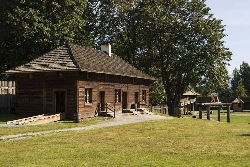
Where is located Fort Langley
Fort Langley — local attraction, which is located at 23433 Mavis Ave, Langley, BC V1M 2R5, Canada and belongs to the category — historical place museum. Average visitor rating for this place — 4.6 (according to 317 ratings, information from open sources and relevant for 2022).
Exact location — Fort Langley, marked on the map with a red marker.
You can get directions to Fort Langley on the map from your location.
What else is interesting in Maple Ridge? You can see all the sights if you go to the city page.
Coordinates
Fort Langley, Canada coordinates in decimal format: latitude — 49.16915122903538, longitude — -122.58305626262319. When converted to degrees, minutes, seconds Fort Langley has the following coordinates: 49°10′8.94 north latitude and -122°34′59 east longitude.
Nearby cities
The largest cities that are located nearby:
- Coquitlam — 16 km
- Surrey — 19 km
- Anmore — 21 km
- Abbotsford — 27 km
- Burnaby — 27 km
- Delta — 34 km
- Vancouver — 38 km
- Richmond — 39 km
- Victoria — 104 km
- Seattle
 (United States) — 179 km
 - Bellevue (United States) — 180 km
- Tacoma (United States) — 218 km
- Kelowna — 233 km
- Portland (United States) — 409 km
- Spokane (United States) — 422 km
- Salem (United States) — 474 km
- Eugene (United States) — 573 km
- Calgary — 626 km
- Edmonton — 766 km
Distance to the capital
Distance to the capital (Ottawa) is about — 3504 km.