
 Staden
Geest-Gerompont-Petit-Rosière
Grote Hut
Sint-Job-in-'t-Goor
Deidenberg
De Pinte
Pussemange
Peruwelz
Barrière de Champlon
Staden
Geest-Gerompont-Petit-Rosière
Grote Hut
Sint-Job-in-'t-Goor
Deidenberg
De Pinte
Pussemange
Peruwelz
Barrière de Champlon
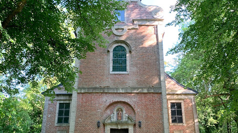
Sint-Hubertuskapel on the map, Zaventem, Belgium
Photo
Where is located Sint-Hubertuskapel
Sint-Hubertuskapel — local attraction, which is located at Kastanjedreef 23, 3080 Tervuren, Belgium and belongs to the category — catholic church. Average visitor rating for this place — 4.1 (according to 8 ratings, information from open sources and relevant for 2022).
Exact location — Sint-Hubertuskapel, marked on the map with a red marker.
You can get directions to Sint-Hubertuskapel on the map from your location.
What else is interesting in Zaventem? You can see all the sights if you go to the city page.
Coordinates
Sint-Hubertuskapel, Belgium coordinates in decimal format: latitude — 51.19518439333105, longitude — 4.639641149656383. When converted to degrees, minutes, seconds Sint-Hubertuskapel has the following coordinates: 51°11′42.66 north latitude and 4°38′22.71 east longitude.
Nearby cities
The largest cities that are located nearby:
- Antwerp — 37 km
- Charleroi — 53 km
- Namur — 54 km
- Breda
 (Netherlands) — 80 km
 - Liège — 83 km
- Maastricht (Netherlands) — 85 km
- Tilburg (Netherlands) — 86 km
- Eindhoven (Netherlands) — 92 km
- Lille
 (France) — 103 km
 - Dordrecht (Netherlands) — 104 km
- 's-Hertogenbosch (Netherlands) — 106 km
- Aachen
 (Germany) — 113 km
 - Rotterdam (Netherlands) — 115 km
- Zoetermeer (Netherlands) — 130 km
- The Hague (Netherlands) — 132 km
- Nijmegen (Netherlands) — 139 km
- Utrecht (Netherlands) — 140 km
- Mönchengladbach (Germany) — 141 km
- Leiden (Netherlands) — 141 km
Distance to the capital
Distance to the capital (Brussels) is about — 43 km.