
 Staden
Geest-Gerompont-Petit-Rosière
Grote Hut
Sint-Job-in-'t-Goor
Deidenberg
De Pinte
Pussemange
Peruwelz
Barrière de Champlon
Staden
Geest-Gerompont-Petit-Rosière
Grote Hut
Sint-Job-in-'t-Goor
Deidenberg
De Pinte
Pussemange
Peruwelz
Barrière de Champlon
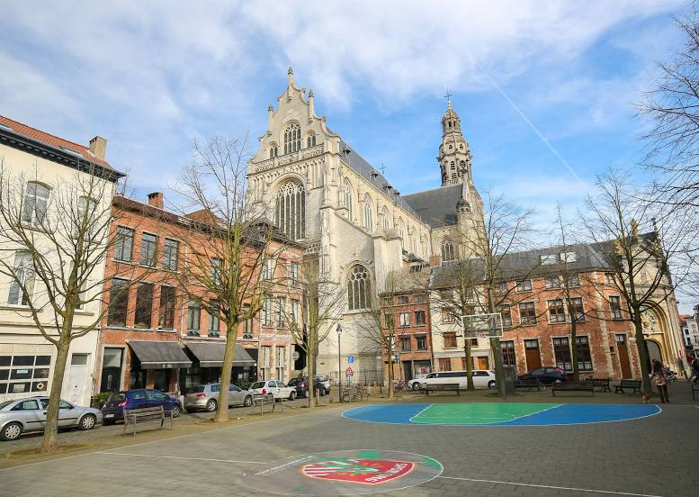
Sint-Pauluskerk on the map, Antwerp, Belgium
Photo
Where is located Sint-Pauluskerk
Sint-Pauluskerk — local attraction, which is located at Sint-Paulusstraat 22, 2000 Antwerpen, Belgium and belongs to the category — catholic church. Average visitor rating for this place — 4.6 (according to 800 ratings, information from open sources and relevant for 2022).
Exact location — Sint-Pauluskerk, marked on the map with a red marker.
You can get directions to Sint-Pauluskerk on the map from your location.
What else is interesting in Antwerp? You can see all the sights if you go to the city page.
Coordinates
Sint-Pauluskerk, Belgium coordinates in decimal format: latitude — 51.224033545062916, longitude — 4.401089807993779. When converted to degrees, minutes, seconds Sint-Pauluskerk has the following coordinates: 51°13′26.52 north latitude and 4°24′3.92 east longitude.
Nearby cities
The largest cities that are located nearby:
- Breda
 (Netherlands) — 48 km
 - Tilburg (Netherlands) — 61 km
- Dordrecht (Netherlands) — 69 km
- Eindhoven (Netherlands) — 78 km
- Rotterdam (Netherlands) — 78 km
- 's-Hertogenbosch (Netherlands) — 81 km
- Charleroi — 89 km
- Namur — 89 km
- Zoetermeer (Netherlands) — 93 km
- The Hague (Netherlands) — 94 km
- Maastricht (Netherlands) — 99 km
- Leiden (Netherlands) — 104 km
- Liège — 105 km
- Utrecht (Netherlands) — 108 km
- Lille
 (France) — 115 km
 - Nijmegen (Netherlands) — 118 km
- Hoofddorp (Netherlands) — 122 km
- Amersfoort (Netherlands) — 123 km
- Ede (Netherlands) — 125 km
Distance to the capital
Distance to the capital (Brussels) is about — 42 km.