 Betteshanger
Lynton
Amesbury
Marlow
Burford
Chipping Norton
Marlborough
Cairnryan
Lydney
Betteshanger
Lynton
Amesbury
Marlow
Burford
Chipping Norton
Marlborough
Cairnryan
Lydney
Manchester Bolton & Bury Reservoir on the map, Bury, United Kingdom
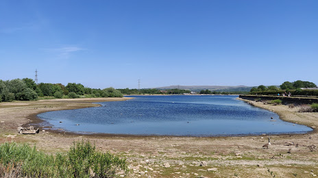
Photo
Where is located Manchester Bolton & Bury Reservoir
Manchester Bolton & Bury Reservoir — local attraction, which is located at 23 ha and belongs to the category — -. Average visitor rating for this place — 4.0 (according to 2 ratings, information from open sources and relevant for 2022).
Exact location — Manchester Bolton & Bury Reservoir, marked on the map with a red marker.
You can get directions to Manchester Bolton & Bury Reservoir on the map from your location.
What else is interesting in Bury? You can see all the sights if you go to the city page.
Coordinates
Manchester Bolton & Bury Reservoir, United Kingdom coordinates in decimal format: latitude — 53.57966351684909, longitude — -2.3206902245327123. When converted to degrees, minutes, seconds Manchester Bolton & Bury Reservoir has the following coordinates: 53°34′46.79 north latitude and -2°19′14.48 east longitude.
Nearby cities
The largest cities that are located nearby:
- Manchester — 13 km
- Blackburn — 21 km
- Preston — 33 km
- Huddersfield — 34 km
- Liverpool — 50 km
- Sheffield — 59 km
- Rotherham — 64 km
- Stoke-on-Trent — 66 km
- Telford — 102 km
- Sutton Coldfield — 117 km
- Dudley — 120 km
- West Bromwich — 121 km
- Birmingham — 125 km
- Leicester — 131 km
- Coventry — 141 km
- Worcester — 155 km
- Sunderland — 156 km
- Northampton — 177 km
- Cheltenham — 188 km
Distance to the capital
Distance to the capital (London) is about — 274 km.