 Betteshanger
Lynton
Amesbury
Marlow
Burford
Chipping Norton
Marlborough
Cairnryan
Lydney
Betteshanger
Lynton
Amesbury
Marlow
Burford
Chipping Norton
Marlborough
Cairnryan
Lydney
Fantasy Island on the map, Southend-on-Sea, United Kingdom
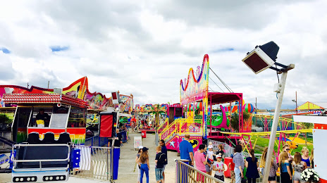
Photo
Where is located Fantasy Island
Fantasy Island — local attraction, which is located at 1-3 Eastern Esplanade, Canvey Island SS8 7DN, United Kingdom and belongs to the category — amusement park on canvey island, england. Average visitor rating for this place — 4.1 (according to 520 ratings, information from open sources and relevant for 2022).
Exact location — Fantasy Island, marked on the map with a red marker.
You can get directions to Fantasy Island on the map from your location.
What else is interesting in Southend-on-Sea? You can see all the sights if you go to the city page.
Coordinates
Fantasy Island, United Kingdom coordinates in decimal format: latitude — 51.51246064044202, longitude — 0.5952487080043433. When converted to degrees, minutes, seconds Fantasy Island has the following coordinates: 51°30′44.86 north latitude and 0°35′42.9 east longitude.
Nearby cities
The largest cities that are located nearby:
- Basildon — 15 km
- Gillingham — 21 km
- Chelmsford — 27 km
- Ipswich — 64 km
- Sutton — 66 km
- Watford — 76 km
- Crawley — 79 km
- Cambridge — 83 km
- Luton — 85 km
- Slough — 90 km
- Eastbourne — 91 km
- Reading — 117 km
- Norwich — 126 km
- Northampton — 133 km
- Oxford — 136 km
- Portsmouth — 149 km
- Southampton — 163 km
- Swindon — 171 km
- Leicester — 173 km
Distance to the capital
Distance to the capital (London) is about — 50 km.