
 Staden
Geest-Gerompont-Petit-Rosière
Grote Hut
Sint-Job-in-'t-Goor
Deidenberg
De Pinte
Pussemange
Peruwelz
Barrière de Champlon
Staden
Geest-Gerompont-Petit-Rosière
Grote Hut
Sint-Job-in-'t-Goor
Deidenberg
De Pinte
Pussemange
Peruwelz
Barrière de Champlon
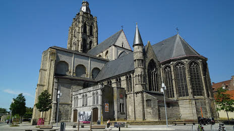
Sint-Walburgakerk on the map, Oudenaarde, Belgium
Photo
Where is located Sint-Walburgakerk
Sint-Walburgakerk — local attraction, which is located at Sint-Walburgastraat, 9700 Oudenaarde, Belgium and belongs to the category — catholic church. Average visitor rating for this place — 4.2 (according to 60 ratings, information from open sources and relevant for 2022).
Exact location — Sint-Walburgakerk, marked on the map with a red marker.
You can get directions to Sint-Walburgakerk on the map from your location.
What else is interesting in Oudenaarde? You can see all the sights if you go to the city page.
Coordinates
Sint-Walburgakerk, Belgium coordinates in decimal format: latitude — 50.8422567055192, longitude — 3.6031316481121474. When converted to degrees, minutes, seconds Sint-Walburgakerk has the following coordinates: 50°50′32.12 north latitude and 3°36′11.27 east longitude.
Nearby cities
The largest cities that are located nearby:
- Lille
 (France) — 45 km
 - Antwerp — 69 km
- Charleroi — 77 km
- Namur — 99 km
- Breda
 (Netherlands) — 115 km
 - Tilburg (Netherlands) — 129 km
- Dordrecht (Netherlands) — 130 km
- Rotterdam (Netherlands) — 133 km
- Amiens (France) — 141 km
- Liège — 141 km
- The Hague (Netherlands) — 143 km
- Eindhoven (Netherlands) — 145 km
- Maastricht (Netherlands) — 146 km
- Zoetermeer (Netherlands) — 147 km
- 's-Hertogenbosch (Netherlands) — 150 km
- Leiden (Netherlands) — 157 km
- Utrecht (Netherlands) — 172 km
- Aachen
 (Germany) — 174 km
 - Hoofddorp (Netherlands) — 177 km
Distance to the capital
Distance to the capital (Brussels) is about — 53 km.