
 Pfarrwerfen
Rosenau am Hengstpaß
Grinzens
Sankt Martin am Wöllmißberg
Sankt Martin am Silberberg
Söding
Felixdorf
Oberpullendorf District
Fließ
Pfarrwerfen
Rosenau am Hengstpaß
Grinzens
Sankt Martin am Wöllmißberg
Sankt Martin am Silberberg
Söding
Felixdorf
Oberpullendorf District
Fließ
Katzenstein on the map, Gmunden, Austria
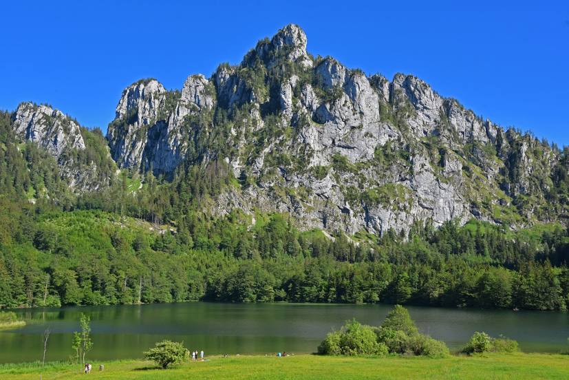
Photo
Where is located Katzenstein
Katzenstein — local attraction, which is located at 1,349 m and belongs to the category — -. Average visitor rating for this place — 4.8 (according to 19 ratings, information from open sources and relevant for 2022).
Exact location — Katzenstein, marked on the map with a red marker.
You can get directions to Katzenstein on the map from your location.
What else is interesting in Gmunden? You can see all the sights if you go to the city page.
Coordinates
Katzenstein, Austria coordinates in decimal format: latitude — 47.87587348139473, longitude — 13.859256784446947. When converted to degrees, minutes, seconds Katzenstein has the following coordinates: 47°52′33.14 north latitude and 13°51′33.32 east longitude.
Nearby cities
The largest cities that are located nearby:
- Linz — 56 km
- Salzburg — 57 km
- Graz — 155 km
- Munich
 (Germany) — 165 km
 - Regensburg (Germany) — 173 km
- Innsbruck — 194 km
- Ingolstadt (Germany) — 197 km
- Pilsen
 (Czech Republic) — 204 km
 - Ljubljana
 (Slovenia) — 213 km
 - Augsburg (Germany) — 219 km
- Prague (Czech Republic) — 243 km
- Bratislava
 (Slovakia) — 245 km
 - Brno (Czech Republic) — 247 km
- Trieste
 (Italy) — 251 km
 - Nuremberg (Germany) — 259 km
- Fürth (Germany) — 265 km
- Erlangen (Germany) — 272 km
- Ulm (Germany) — 285 km
- Zagreb
 (Croatia) — 287 km
Distance to the capital
Distance to the capital (Vienna) is about — 191 km.