 Staden
Geest-Gerompont-Petit-Rosière
Grote Hut
Sint-Job-in-'t-Goor
Deidenberg
De Pinte
Pussemange
Peruwelz
Barrière de Champlon
Staden
Geest-Gerompont-Petit-Rosière
Grote Hut
Sint-Job-in-'t-Goor
Deidenberg
De Pinte
Pussemange
Peruwelz
Barrière de Champlon
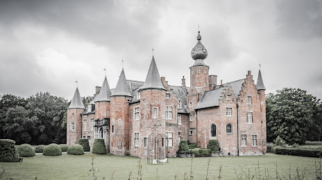
MUZE'UM L : licht en landschap on the map, Roeselare, Belgium
Photo
Where is located MUZE'UM L : licht en landschap
MUZE'UM L : licht en landschap — local attraction, which is located at no data and belongs to the category — -. Average visitor rating for this place — 4.4 (according to 153 ratings, information from open sources and relevant for 2022).
Exact location — MUZE'UM L : licht en landschap, marked on the map with a red marker.
You can get directions to MUZE'UM L : licht en landschap on the map from your location.
What else is interesting in Roeselare? You can see all the sights if you go to the city page.
Coordinates
MUZE'UM L : licht en landschap, Belgium coordinates in decimal format: latitude — 50.926609592728056, longitude — 3.132905842841856. When converted to degrees, minutes, seconds MUZE'UM L : licht en landschap has the following coordinates: 50°55′35.79 north latitude and 3°7′58.46 east longitude.
Nearby cities
The largest cities that are located nearby:
- Lille
 (France) — 36 km
 - Antwerp — 93 km
- Charleroi — 110 km
- Amiens (France) — 131 km
- Breda
 (Netherlands) — 133 km
 - Namur — 134 km
- Rotterdam (Netherlands) — 142 km
- Dordrecht (Netherlands) — 143 km
- The Hague (Netherlands) — 147 km
- Tilburg (Netherlands) — 151 km
- Zoetermeer (Netherlands) — 154 km
- Leiden (Netherlands) — 163 km
- Eindhoven (Netherlands) — 170 km
- 's-Hertogenbosch (Netherlands) — 170 km
- Liège — 175 km
- Southend-on-Sea
 (United Kingdom) — 179 km
 - Maastricht (Netherlands) — 179 km
- Ipswich (United Kingdom) — 182 km
- Hoofddorp (Netherlands) — 183 km
Distance to the capital
Distance to the capital (Brussels) is about — 86 km.