
 Staden
Geest-Gerompont-Petit-Rosière
Grote Hut
Sint-Job-in-'t-Goor
Deidenberg
De Pinte
Pussemange
Peruwelz
Barrière de Champlon
Staden
Geest-Gerompont-Petit-Rosière
Grote Hut
Sint-Job-in-'t-Goor
Deidenberg
De Pinte
Pussemange
Peruwelz
Barrière de Champlon
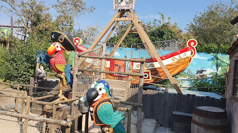
Jungle City - Amusement park on the map, Tournai, Belgium
Photo
Where is located Jungle City - Amusement park
Jungle City - Amusement park — local attraction, which is located at Quai des Vicinaux 34, 7500 Tournai, Belgium and belongs to the category — amusement park. Average visitor rating for this place — 4.0 (according to 1781 rating, information from open sources and relevant for 2022).
Exact location — Jungle City - Amusement park, marked on the map with a red marker.
You can get directions to Jungle City - Amusement park on the map from your location.
What else is interesting in Tournai? You can see all the sights if you go to the city page.
Coordinates
Jungle City - Amusement park, Belgium coordinates in decimal format: latitude — 50.620357844644865, longitude — 3.380401498104106. When converted to degrees, minutes, seconds Jungle City - Amusement park has the following coordinates: 50°37′13.29 north latitude and 3°22′49.45 east longitude.
Nearby cities
The largest cities that are located nearby:
- Lille
 (France) — 23 km
 - Charleroi — 78 km
- Antwerp — 98 km
- Namur — 106 km
- Amiens (France) — 111 km
- Breda
 (Netherlands) — 144 km
 - Liège — 154 km
- Reims (France) — 156 km
- Tilburg (Netherlands) — 158 km
- Dordrecht (Netherlands) — 160 km
- Maastricht (Netherlands) — 163 km
- Rotterdam (Netherlands) — 164 km
- Eindhoven (Netherlands) — 171 km
- The Hague (Netherlands) — 173 km
- Zoetermeer (Netherlands) — 178 km
- 's-Hertogenbosch (Netherlands) — 178 km
- Leiden (Netherlands) — 188 km
- Aachen
 (Germany) — 189 km
 - Utrecht (Netherlands) — 202 km
Distance to the capital
Distance to the capital (Brussels) is about — 73 km.