
 Staden
Geest-Gerompont-Petit-Rosière
Grote Hut
Sint-Job-in-'t-Goor
Deidenberg
De Pinte
Pussemange
Peruwelz
Barrière de Champlon
Staden
Geest-Gerompont-Petit-Rosière
Grote Hut
Sint-Job-in-'t-Goor
Deidenberg
De Pinte
Pussemange
Peruwelz
Barrière de Champlon
Bois des Bruyères on the map, Sint-Genesius-Rode, Belgium
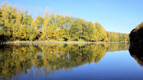
Photo
Where is located Bois des Bruyères
Bois des Bruyères — local attraction, which is located at no data and belongs to the category — -. Average visitor rating for this place — 4.5 (according to 36 ratings, information from open sources and relevant for 2022).
Exact location — Bois des Bruyères, marked on the map with a red marker.
You can get directions to Bois des Bruyères on the map from your location.
What else is interesting in Sint-Genesius-Rode? You can see all the sights if you go to the city page.
Coordinates
Bois des Bruyères, Belgium coordinates in decimal format: latitude — 50.71769198934716, longitude — 4.378314942811404. When converted to degrees, minutes, seconds Bois des Bruyères has the following coordinates: 50°43′3.69 north latitude and 4°22′41.93 east longitude.
Nearby cities
The largest cities that are located nearby:
- Charleroi — 38 km
- Namur — 48 km
- Antwerp — 52 km
- Liège — 87 km
- Lille
 (France) — 92 km
 - Maastricht
 (Netherlands) — 94 km
 - Breda (Netherlands) — 97 km
- Tilburg (Netherlands) — 103 km
- Eindhoven (Netherlands) — 109 km
- Dordrecht (Netherlands) — 120 km
- Aachen
 (Germany) — 121 km
 - 's-Hertogenbosch (Netherlands) — 124 km
- Rotterdam (Netherlands) — 131 km
- Zoetermeer (Netherlands) — 146 km
- The Hague (Netherlands) — 146 km
- Mönchengladbach (Germany) — 152 km
- Nijmegen (Netherlands) — 155 km
- Leiden (Netherlands) — 157 km
- Utrecht (Netherlands) — 157 km
Distance to the capital
Distance to the capital (Brussels) is about — 15 km.