
 Staden
Geest-Gerompont-Petit-Rosière
Grote Hut
Sint-Job-in-'t-Goor
Deidenberg
De Pinte
Pussemange
Peruwelz
Barrière de Champlon
Staden
Geest-Gerompont-Petit-Rosière
Grote Hut
Sint-Job-in-'t-Goor
Deidenberg
De Pinte
Pussemange
Peruwelz
Barrière de Champlon
Château de Corroy-le-Château on the map, Gembloux, Belgium
Photo
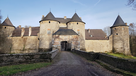
Where is located Château de Corroy-le-Château
Château de Corroy-le-Château — local attraction, which is located at Rue du Château de Corroy 4, 5032 Gembloux, Belgium and belongs to the category — medieval castle. Average visitor rating for this place — 4.3 (according to 186 ratings, information from open sources and relevant for 2022).
Exact location — Château de Corroy-le-Château, marked on the map with a red marker.
You can get directions to Château de Corroy-le-Château on the map from your location.
What else is interesting in Gembloux? You can see all the sights if you go to the city page.
Coordinates
Château de Corroy-le-Château, Belgium coordinates in decimal format: latitude — 50.53307518150584, longitude — 4.656089898100901. When converted to degrees, minutes, seconds Château de Corroy-le-Château has the following coordinates: 50°31′59.07 north latitude and 4°39′21.92 east longitude.
Nearby cities
The largest cities that are located nearby:
- Namur — 17 km
- Charleroi — 24 km
- Liège — 63 km
- Antwerp — 75 km
- Maastricht
 (Netherlands) — 77 km
 - Aachen
 (Germany) — 100 km
 - Eindhoven (Netherlands) — 111 km
- Breda (Netherlands) — 113 km
- Tilburg (Netherlands) — 113 km
- Lille
 (France) — 115 km
 - 's-Hertogenbosch (Netherlands) — 132 km
- Dordrecht (Netherlands) — 138 km
- Mönchengladbach (Germany) — 139 km
- Rotterdam (Netherlands) — 151 km
- Reims (France) — 152 km
- Neuss (Germany) — 155 km
- Krefeld (Germany) — 156 km
- Nijmegen (Netherlands) — 159 km
- Düsseldorf (Germany) — 162 km
Distance to the capital
Distance to the capital (Brussels) is about — 41 km.