 Betteshanger
Lynton
Amesbury
Marlow
Burford
Chipping Norton
Marlborough
Cairnryan
Lydney
Betteshanger
Lynton
Amesbury
Marlow
Burford
Chipping Norton
Marlborough
Cairnryan
Lydney
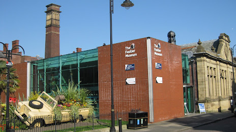
The Fusilier Museum on the map, Salford, United Kingdom
Photo
Where is located The Fusilier Museum
The Fusilier Museum — local attraction, which is located at Moss St, Bury BL9 0DF, United Kingdom and belongs to the category — museum. Average visitor rating for this place — 4.6 (according to 272 ratings, information from open sources and relevant for 2022).
Exact location — The Fusilier Museum, marked on the map with a red marker.
You can get directions to The Fusilier Museum on the map from your location.
What else is interesting in Salford? You can see all the sights if you go to the city page.
Coordinates
The Fusilier Museum, United Kingdom coordinates in decimal format: latitude — 53.592253525037066, longitude — -2.2985903016273475. When converted to degrees, minutes, seconds The Fusilier Museum has the following coordinates: 53°35′32.11 north latitude and -2°17′54.93 east longitude.
Nearby cities
The largest cities that are located nearby:
- Manchester — 3 km
- Blackburn — 32 km
- Huddersfield — 37 km
- Preston — 41 km
- Liverpool — 47 km
- Stoke-on-Trent — 54 km
- Sheffield — 55 km
- Rotherham — 61 km
- Telford — 90 km
- Sutton Coldfield — 106 km
- Dudley — 109 km
- West Bromwich — 109 km
- Birmingham — 114 km
- Leicester — 122 km
- Coventry — 130 km
- Worcester — 143 km
- Northampton — 167 km
- Sunderland — 167 km
- Cheltenham — 176 km
Distance to the capital
Distance to the capital (London) is about — 274 km.