
 Pfarrwerfen
Rosenau am Hengstpaß
Grinzens
Sankt Martin am Wöllmißberg
Sankt Martin am Silberberg
Söding
Felixdorf
Oberpullendorf District
Fließ
Pfarrwerfen
Rosenau am Hengstpaß
Grinzens
Sankt Martin am Wöllmißberg
Sankt Martin am Silberberg
Söding
Felixdorf
Oberpullendorf District
Fließ
Ö. Sattlermuseum on the map, Steyr, Austria
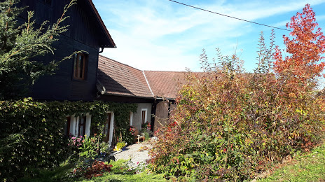
Photo
Where is located Ö. Sattlermuseum
Ö. Sattlermuseum — local attraction, which is located at Ipfmühlstraße 15, 4492 Hofkirchen im Traunkreis, Austria and belongs to the category — museum. Average visitor rating for this place — - (according to 10 ratings, information from open sources and relevant for 2022).
Exact location — Ö. Sattlermuseum, marked on the map with a red marker.
You can get directions to Ö. Sattlermuseum on the map from your location.
What else is interesting in Steyr? You can see all the sights if you go to the city page.
Coordinates
Ö. Sattlermuseum, Austria coordinates in decimal format: latitude — 48.14506260376279, longitude — 14.39168145963858. When converted to degrees, minutes, seconds Ö. Sattlermuseum has the following coordinates: 48°8′42.23 north latitude and 14°23′30.05 east longitude.
Nearby cities
The largest cities that are located nearby:
- Linz — 30 km
- Salzburg — 105 km
- Graz — 133 km
- Bratislava
 (Slovakia) — 199 km
 - Regensburg
 (Germany) — 199 km
 - Pilsen
 (Czech Republic) — 201 km
 - Brno (Czech Republic) — 203 km
- Munich (Germany) — 210 km
- Ljubljana
 (Slovenia) — 220 km
 - Prague (Czech Republic) — 224 km
- Ingolstadt (Germany) — 232 km
- Innsbruck — 242 km
- Győr
 (Hungary) — 244 km
 - Augsburg (Germany) — 261 km
- Olomouc (Czech Republic) — 265 km
- Trieste
 (Italy) — 270 km
 - Zagreb
 (Croatia) — 275 km
 - Nuremberg (Germany) — 286 km
- Fürth (Germany) — 293 km
Distance to the capital
Distance to the capital (Vienna) is about — 147 km.