
 Staden
Geest-Gerompont-Petit-Rosière
Grote Hut
Sint-Job-in-'t-Goor
Deidenberg
De Pinte
Pussemange
Peruwelz
Barrière de Champlon
Staden
Geest-Gerompont-Petit-Rosière
Grote Hut
Sint-Job-in-'t-Goor
Deidenberg
De Pinte
Pussemange
Peruwelz
Barrière de Champlon
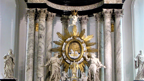
Virga-Jessebasiliek on the map, Hasselt, Belgium
Photo
Where is located Virga-Jessebasiliek
Virga-Jessebasiliek — local attraction, which is located at Kapelstraat, 3500 Hasselt, Belgium and belongs to the category — basilica. Average visitor rating for this place — 5.0 (according to 1 rating, information from open sources and relevant for 2022).
Exact location — Virga-Jessebasiliek, marked on the map with a red marker.
You can get directions to Virga-Jessebasiliek on the map from your location.
What else is interesting in Hasselt? You can see all the sights if you go to the city page.
Coordinates
Virga-Jessebasiliek, Belgium coordinates in decimal format: latitude — 50.92960703746311, longitude — 5.336550859738133. When converted to degrees, minutes, seconds Virga-Jessebasiliek has the following coordinates: 50°55′46.59 north latitude and 5°20′11.58 east longitude.
Nearby cities
The largest cities that are located nearby:
- Maastricht
 (Netherlands) — 27 km
 - Liège — 37 km
- Aachen
 (Germany) — 55 km
 - Eindhoven (Netherlands) — 57 km
- Namur — 61 km
- Tilburg (Netherlands) — 72 km
- Antwerp — 72 km
- Breda (Netherlands) — 82 km
- Mönchengladbach (Germany) — 82 km
- 's-Hertogenbosch (Netherlands) — 85 km
- Charleroi — 85 km
- Krefeld (Germany) — 98 km
- Neuss (Germany) — 99 km
- Nijmegen (Netherlands) — 103 km
- Düsseldorf (Germany) — 105 km
- Moers (Germany) — 107 km
- Dordrecht (Netherlands) — 107 km
- Duisburg (Germany) — 113 km
- Cologne (Germany) — 113 km
Distance to the capital
Distance to the capital (Brussels) is about — 70 km.