 Staden
Geest-Gerompont-Petit-Rosière
Grote Hut
Sint-Job-in-'t-Goor
Deidenberg
De Pinte
Pussemange
Peruwelz
Barrière de Champlon
Staden
Geest-Gerompont-Petit-Rosière
Grote Hut
Sint-Job-in-'t-Goor
Deidenberg
De Pinte
Pussemange
Peruwelz
Barrière de Champlon
Park 58 on the map, Knokke-Heist, Belgium
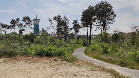
Photo
Where is located Park 58
Park 58 — local attraction, which is located at Theresialaan 9, 8301 Knokke-Heist, Belgium and belongs to the category — national park. Average visitor rating for this place — 3.8 (according to 28 ratings, information from open sources and relevant for 2022).
Exact location — Park 58, marked on the map with a red marker.
You can get directions to Park 58 on the map from your location.
What else is interesting in Knokke-Heist? You can see all the sights if you go to the city page.
Coordinates
Park 58, Belgium coordinates in decimal format: latitude — 51.34348562165801, longitude — 3.2701742253133785. When converted to degrees, minutes, seconds Park 58 has the following coordinates: 51°20′36.55 north latitude and 3°16′12.63 east longitude.
Nearby cities
The largest cities that are located nearby:
- Antwerp — 79 km
- Lille
 (France) — 81 km
 - Rotterdam
 (Netherlands) — 103 km
 - The Hague (Netherlands) — 106 km
- Breda (Netherlands) — 106 km
- Dordrecht (Netherlands) — 109 km
- Zoetermeer (Netherlands) — 114 km
- Leiden (Netherlands) — 122 km
- Tilburg (Netherlands) — 126 km
- Charleroi — 132 km
- Hoofddorp (Netherlands) — 142 km
- 's-Hertogenbosch (Netherlands) — 144 km
- Haarlem (Netherlands) — 147 km
- Namur — 148 km
- Utrecht (Netherlands) — 149 km
- Eindhoven (Netherlands) — 151 km
- Amsterdam (Netherlands) — 157 km
- Ipswich
 (United Kingdom) — 165 km
 - Amersfoort (Netherlands) — 168 km
Distance to the capital
Distance to the capital (Brussels) is about — 93 km.