
 Staden
Geest-Gerompont-Petit-Rosière
Grote Hut
Sint-Job-in-'t-Goor
Deidenberg
De Pinte
Pussemange
Peruwelz
Barrière de Champlon
Staden
Geest-Gerompont-Petit-Rosière
Grote Hut
Sint-Job-in-'t-Goor
Deidenberg
De Pinte
Pussemange
Peruwelz
Barrière de Champlon
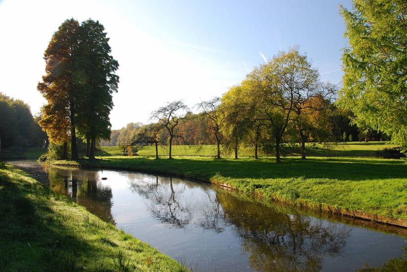
Park van Tervuren on the map, Wezembeek-Oppem, Belgium
Photo
Where is located Park van Tervuren
Park van Tervuren — local attraction, which is located at Leuvensesteenweg 13, 3080 Tervuren, Belgium and belongs to the category — park. Average visitor rating for this place — 4.6 (according to 1423 ratings, information from open sources and relevant for 2022).
Exact location — Park van Tervuren, marked on the map with a red marker.
You can get directions to Park van Tervuren on the map from your location.
What else is interesting in Wezembeek-Oppem? You can see all the sights if you go to the city page.
Coordinates
Park van Tervuren, Belgium coordinates in decimal format: latitude — 50.82798977295317, longitude — 4.528457607417828. When converted to degrees, minutes, seconds Park van Tervuren has the following coordinates: 50°49′40.76 north latitude and 4°31′42.45 east longitude.
Nearby cities
The largest cities that are located nearby:
- Antwerp — 41 km
- Charleroi — 49 km
- Namur — 50 km
- Liège — 80 km
- Breda
 (Netherlands) — 83 km
 - Maastricht (Netherlands) — 84 km
- Tilburg (Netherlands) — 89 km
- Eindhoven (Netherlands) — 94 km
- Lille
 (France) — 103 km
 - Dordrecht (Netherlands) — 107 km
- 's-Hertogenbosch (Netherlands) — 109 km
- Aachen
 (Germany) — 112 km
 - Rotterdam (Netherlands) — 119 km
- Zoetermeer (Netherlands) — 134 km
- The Hague (Netherlands) — 135 km
- Mönchengladbach (Germany) — 140 km
- Nijmegen (Netherlands) — 141 km
- Utrecht (Netherlands) — 144 km
- Leiden (Netherlands) — 145 km
Distance to the capital
Distance to the capital (Brussels) is about — 13 km.