
 Staden
Geest-Gerompont-Petit-Rosière
Grote Hut
Sint-Job-in-'t-Goor
Deidenberg
De Pinte
Pussemange
Peruwelz
Barrière de Champlon
Staden
Geest-Gerompont-Petit-Rosière
Grote Hut
Sint-Job-in-'t-Goor
Deidenberg
De Pinte
Pussemange
Peruwelz
Barrière de Champlon
Fort Eben-Emael on the map, Riemst, Belgium
Photo
Where is located Fort Eben-Emael
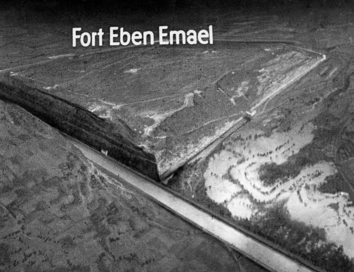
Fort Eben-Emael — local attraction, which is located at Rue du Fort 40, 4690 Eben-Emael, Belgium and belongs to the category — fortress. Average visitor rating for this place — 4.5 (according to 2155 ratings, information from open sources and relevant for 2022).
Exact location — Fort Eben-Emael, marked on the map with a red marker.
You can get directions to Fort Eben-Emael on the map from your location.
What else is interesting in Riemst? You can see all the sights if you go to the city page.
Coordinates
Fort Eben-Emael, Belgium coordinates in decimal format: latitude — 50.79753946370412, longitude — 5.67884252529341. When converted to degrees, minutes, seconds Fort Eben-Emael has the following coordinates: 50°47′51.14 north latitude and 5°40′43.83 east longitude.
Nearby cities
The largest cities that are located nearby:
- Maastricht
 (Netherlands) — 8 km
 - Liège — 20 km
- Aachen
 (Germany) — 34 km
 - Namur — 64 km
- Eindhoven (Netherlands) — 71 km
- Mönchengladbach (Germany) — 71 km
- Neuss (Germany) — 87 km
- Krefeld (Germany) — 90 km
- Tilburg (Netherlands) — 90 km
- Charleroi — 93 km
- Düsseldorf (Germany) — 93 km
- Antwerp — 95 km
- Cologne (Germany) — 96 km
- 's-Hertogenbosch (Netherlands) — 100 km
- Moers (Germany) — 101 km
- Breda (Netherlands) — 103 km
- Bonn (Germany) — 105 km
- Duisburg (Germany) — 106 km
- Bergisch Gladbach (Germany) — 108 km
Distance to the capital
Distance to the capital (Brussels) is about — 93 km.