 Betteshanger
Lynton
Amesbury
Marlow
Burford
Chipping Norton
Marlborough
Cairnryan
Lydney
Betteshanger
Lynton
Amesbury
Marlow
Burford
Chipping Norton
Marlborough
Cairnryan
Lydney
Ellenborough Park East on the map, Weston-super-Mare, United Kingdom
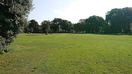
Photo
Where is located Ellenborough Park East
Ellenborough Park East — local attraction, which is located at Ellenborough Park N, Weston-super-Mare BS23 1XH, United Kingdom and belongs to the category — park. Average visitor rating for this place — 4.1 (according to 173 ratings, information from open sources and relevant for 2022).
Exact location — Ellenborough Park East, marked on the map with a red marker.
You can get directions to Ellenborough Park East on the map from your location.
What else is interesting in Weston-super-Mare? You can see all the sights if you go to the city page.
Coordinates
Ellenborough Park East, United Kingdom coordinates in decimal format: latitude — 51.34212052075957, longitude — -2.9769954746866802. When converted to degrees, minutes, seconds Ellenborough Park East has the following coordinates: 51°20′31.63 north latitude and -2°58′37.18 east longitude.
Nearby cities
The largest cities that are located nearby:
- Bristol — 29 km
- Exeter — 80 km
- Swindon — 85 km
- Cheltenham — 87 km
- Bournemouth — 104 km
- Worcester — 107 km
- Southampton — 120 km
- Oxford — 126 km
- Reading — 138 km
- Dudley — 142 km
- Portsmouth — 144 km
- West Bromwich — 145 km
- Birmingham — 146 km
- Telford — 151 km
- Coventry — 153 km
- Sutton Coldfield — 156 km
- Slough — 165 km
- Northampton — 172 km
- Watford — 181 km
Distance to the capital
Distance to the capital (London) is about — 198 km.