
 Staden
Geest-Gerompont-Petit-Rosière
Grote Hut
Sint-Job-in-'t-Goor
Deidenberg
De Pinte
Pussemange
Peruwelz
Barrière de Champlon
Staden
Geest-Gerompont-Petit-Rosière
Grote Hut
Sint-Job-in-'t-Goor
Deidenberg
De Pinte
Pussemange
Peruwelz
Barrière de Champlon
Sint-Sulpitiuskerk on the map, Diest, Belgium
Photo
Where is located Sint-Sulpitiuskerk
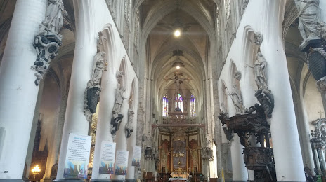
Sint-Sulpitiuskerk — local attraction, which is located at Grote Markt, 3290 Diest, Belgium and belongs to the category — catholic church. Average visitor rating for this place — 4.2 (according to 77 ratings, information from open sources and relevant for 2022).
Exact location — Sint-Sulpitiuskerk, marked on the map with a red marker.
You can get directions to Sint-Sulpitiuskerk on the map from your location.
What else is interesting in Diest? You can see all the sights if you go to the city page.
Coordinates
Sint-Sulpitiuskerk, Belgium coordinates in decimal format: latitude — 50.984698786105405, longitude — 5.0506053253002445. When converted to degrees, minutes, seconds Sint-Sulpitiuskerk has the following coordinates: 50°59′4.92 north latitude and 5°3′2.18 east longitude.
Nearby cities
The largest cities that are located nearby:
- Maastricht
 (Netherlands) — 47 km
 - Antwerp — 52 km
- Liège — 54 km
- Eindhoven (Netherlands) — 58 km
- Namur — 59 km
- Tilburg (Netherlands) — 63 km
- Breda (Netherlands) — 68 km
- Aachen
 (Germany) — 76 km
 - Charleroi — 77 km
- 's-Hertogenbosch (Netherlands) — 80 km
- Dordrecht (Netherlands) — 94 km
- Mönchengladbach (Germany) — 99 km
- Nijmegen (Netherlands) — 106 km
- Rotterdam (Netherlands) — 110 km
- Krefeld (Germany) — 113 km
- Neuss (Germany) — 116 km
- Moers (Germany) — 121 km
- Utrecht (Netherlands) — 122 km
- Düsseldorf (Germany) — 122 km
Distance to the capital
Distance to the capital (Brussels) is about — 51 km.