
 Staden
Geest-Gerompont-Petit-Rosière
Grote Hut
Sint-Job-in-'t-Goor
Deidenberg
De Pinte
Pussemange
Peruwelz
Barrière de Champlon
Staden
Geest-Gerompont-Petit-Rosière
Grote Hut
Sint-Job-in-'t-Goor
Deidenberg
De Pinte
Pussemange
Peruwelz
Barrière de Champlon
Natuurpunt Oude Spoorweg - De Mosterdpot on the map, Machelen, Belgium
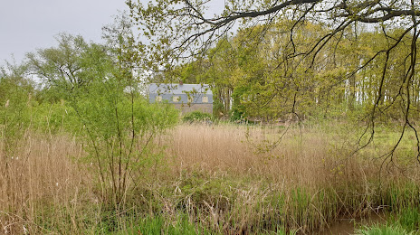
Photo
Where is located Natuurpunt Oude Spoorweg - De Mosterdpot
Natuurpunt Oude Spoorweg - De Mosterdpot — local attraction, which is located at Mechelsebaan 218, 2570 Duffel, Belgium and belongs to the category — nature preserve. Average visitor rating for this place — 4.6 (according to 47 ratings, information from open sources and relevant for 2022).
Exact location — Natuurpunt Oude Spoorweg - De Mosterdpot, marked on the map with a red marker.
You can get directions to Natuurpunt Oude Spoorweg - De Mosterdpot on the map from your location.
What else is interesting in Machelen? You can see all the sights if you go to the city page.
Coordinates
Natuurpunt Oude Spoorweg - De Mosterdpot, Belgium coordinates in decimal format: latitude — 51.080213648697004, longitude — 4.490226625303714. When converted to degrees, minutes, seconds Natuurpunt Oude Spoorweg - De Mosterdpot has the following coordinates: 51°4′48.77 north latitude and 4°29′24.82 east longitude.
Nearby cities
The largest cities that are located nearby:
- Antwerp — 34 km
- Charleroi — 55 km
- Namur — 58 km
- Breda
 (Netherlands) — 78 km
 - Tilburg (Netherlands) — 85 km
- Liège — 86 km
- Maastricht (Netherlands) — 88 km
- Eindhoven (Netherlands) — 92 km
- Dordrecht (Netherlands) — 101 km
- Lille
 (France) — 102 km
 - 's-Hertogenbosch (Netherlands) — 105 km
- Rotterdam (Netherlands) — 112 km
- Aachen
 (Germany) — 116 km
 - Zoetermeer (Netherlands) — 127 km
- The Hague (Netherlands) — 128 km
- Leiden (Netherlands) — 138 km
- Nijmegen (Netherlands) — 138 km
- Utrecht (Netherlands) — 138 km
- Mönchengladbach (Germany) — 142 km
Distance to the capital
Distance to the capital (Brussels) is about — 27 km.