
 Staden
Geest-Gerompont-Petit-Rosière
Grote Hut
Sint-Job-in-'t-Goor
Deidenberg
De Pinte
Pussemange
Peruwelz
Barrière de Champlon
Staden
Geest-Gerompont-Petit-Rosière
Grote Hut
Sint-Job-in-'t-Goor
Deidenberg
De Pinte
Pussemange
Peruwelz
Barrière de Champlon
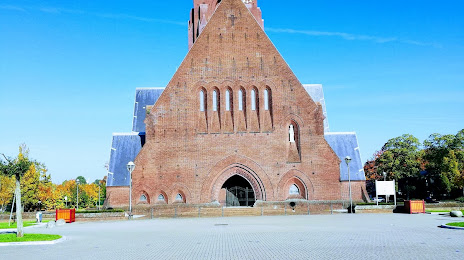
Sint-Barbarakerk on the map, maasmechelen, Belgium
Photo
Where is located Sint-Barbarakerk
Sint-Barbarakerk — local attraction, which is located at Kastanjelaan, 3630 Maasmechelen, Belgium and belongs to the category — church. Average visitor rating for this place — 4.3 (according to 3 ratings, information from open sources and relevant for 2022).
Exact location — Sint-Barbarakerk, marked on the map with a red marker.
You can get directions to Sint-Barbarakerk on the map from your location.
What else is interesting in maasmechelen? You can see all the sights if you go to the city page.
Coordinates
Sint-Barbarakerk, Belgium coordinates in decimal format: latitude — 50.993963692172976, longitude — 5.686052925300587. When converted to degrees, minutes, seconds Sint-Barbarakerk has the following coordinates: 50°59′38.27 north latitude and 5°41′9.79 east longitude.
Nearby cities
The largest cities that are located nearby:
- Maastricht
 (Netherlands) — 14 km
 - Aachen
 (Germany) — 35 km
 - Liège — 39 km
- Eindhoven (Netherlands) — 54 km
- Mönchengladbach (Germany) — 56 km
- Neuss (Germany) — 73 km
- Krefeld (Germany) — 73 km
- Tilburg (Netherlands) — 77 km
- Düsseldorf (Germany) — 79 km
- Namur — 81 km
- Moers (Germany) — 83 km
- 's-Hertogenbosch (Netherlands) — 84 km
- Cologne (Germany) — 88 km
- Duisburg (Germany) — 89 km
- Breda (Netherlands) — 92 km
- Nijmegen (Netherlands) — 93 km
- Antwerp — 94 km
- Mülheim (Germany) — 95 km
- Solingen (Germany) — 98 km
Distance to the capital
Distance to the capital (Brussels) is about — 95 km.