
 Staden
Geest-Gerompont-Petit-Rosière
Grote Hut
Sint-Job-in-'t-Goor
Deidenberg
De Pinte
Pussemange
Peruwelz
Barrière de Champlon
Staden
Geest-Gerompont-Petit-Rosière
Grote Hut
Sint-Job-in-'t-Goor
Deidenberg
De Pinte
Pussemange
Peruwelz
Barrière de Champlon
Borderpark Kempen~Broek (Kempen~Broek) on the map, Kinrooi, Belgium
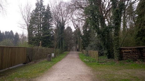
Photo
Where is located Borderpark Kempen~Broek (Kempen~Broek)
Borderpark Kempen~Broek (Kempen~Broek) — local attraction, which is located at Mariahofstraat 51, 3960 Bree, Belgium and belongs to the category — nature preserve. Average visitor rating for this place — 4.1 (according to 13 ratings, information from open sources and relevant for 2022).
Exact location — Borderpark Kempen~Broek (Kempen~Broek), marked on the map with a red marker.
You can get directions to Borderpark Kempen~Broek (Kempen~Broek) on the map from your location.
What else is interesting in Kinrooi? You can see all the sights if you go to the city page.
Coordinates
Borderpark Kempen~Broek (Kempen~Broek), Belgium coordinates in decimal format: latitude — 51.17632531176506, longitude — 5.68576262530727. When converted to degrees, minutes, seconds Borderpark Kempen~Broek (Kempen~Broek) has the following coordinates: 51°10′34.77 north latitude and 5°41′8.75 east longitude.
Nearby cities
The largest cities that are located nearby:
- Maastricht
 (Netherlands) — 33 km
 - Eindhoven (Netherlands) — 38 km
- Aachen
 (Germany) — 47 km
 - Mönchengladbach (Germany) — 49 km
- Liège — 58 km
- Krefeld (Germany) — 62 km
- Tilburg (Netherlands) — 64 km
- Neuss (Germany) — 66 km
- 's-Hertogenbosch (Netherlands) — 68 km
- Moers (Germany) — 71 km
- Düsseldorf (Germany) — 72 km
- Nijmegen (Netherlands) — 74 km
- Duisburg (Germany) — 77 km
- Breda (Netherlands) — 82 km
- Mülheim (Germany) — 84 km
- Oberhausen (Germany) — 86 km
- Cologne (Germany) — 88 km
- Bottrop (Germany) — 93 km
- Antwerp — 93 km
Distance to the capital
Distance to the capital (Brussels) is about — 100 km.