 Betteshanger
Lynton
Amesbury
Marlow
Burford
Chipping Norton
Marlborough
Cairnryan
Lydney
Betteshanger
Lynton
Amesbury
Marlow
Burford
Chipping Norton
Marlborough
Cairnryan
Lydney
Telford Snowboard & Ski Centre on the map, Telford, United Kingdom
Photo
Where is located Telford Snowboard & Ski Centre
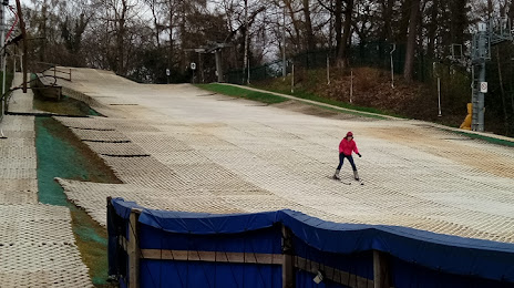
Telford Snowboard & Ski Centre — local attraction, which is located at Court St, Telford TF7 5EE, United Kingdom and belongs to the category — ski resort. Average visitor rating for this place — 4.8 (according to 26 ratings, information from open sources and relevant for 2022).
Exact location — Telford Snowboard & Ski Centre, marked on the map with a red marker.
You can get directions to Telford Snowboard & Ski Centre on the map from your location.
What else is interesting in Telford? You can see all the sights if you go to the city page.
Coordinates
Telford Snowboard & Ski Centre, United Kingdom coordinates in decimal format: latitude — 52.680996289778655, longitude — -2.490246740584833. When converted to degrees, minutes, seconds Telford Snowboard & Ski Centre has the following coordinates: 52°40′51.59 north latitude and -2°29′24.89 east longitude.
Nearby cities
The largest cities that are located nearby:
- Dudley — 31 km
- West Bromwich — 35 km
- Stoke-on-Trent — 40 km
- Birmingham — 43 km
- Sutton Coldfield — 43 km
- Worcester — 56 km
- Coventry — 69 km
- Leicester — 88 km
- Liverpool — 88 km
- Cheltenham — 90 km
- Manchester — 90 km
- Sheffield — 101 km
- Rotherham — 110 km
- Northampton — 115 km
- Huddersfield — 115 km
- Blackburn — 118 km
- Preston — 121 km
- Oxford — 131 km
- Swindon — 132 km
Distance to the capital
Distance to the capital (London) is about — 208 km.