 Betteshanger
Lynton
Amesbury
Marlow
Burford
Chipping Norton
Marlborough
Cairnryan
Lydney
Betteshanger
Lynton
Amesbury
Marlow
Burford
Chipping Norton
Marlborough
Cairnryan
Lydney
Mesolithic Site Mountsandel on the map, Coleraine, United Kingdom
Photo
Where is located Mesolithic Site Mountsandel
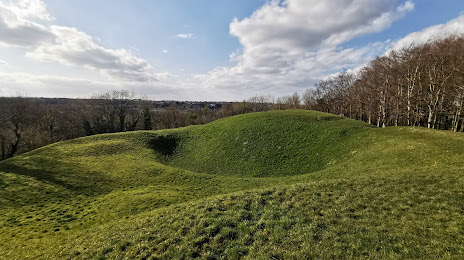
Mesolithic Site Mountsandel — local attraction, which is located at 2 Mountfield Dr, Coleraine BT52 1TW, United Kingdom and belongs to the category — tourist attraction. Average visitor rating for this place — 4.5 (according to 118 ratings, information from open sources and relevant for 2022).
Exact location — Mesolithic Site Mountsandel, marked on the map with a red marker.
You can get directions to Mesolithic Site Mountsandel on the map from your location.
What else is interesting in Coleraine? You can see all the sights if you go to the city page.
Coordinates
Mesolithic Site Mountsandel, United Kingdom coordinates in decimal format: latitude — 55.1162710685772, longitude — -6.664170874544672. When converted to degrees, minutes, seconds Mesolithic Site Mountsandel has the following coordinates: 55°6′58.58 north latitude and -6°39′51.02 east longitude.
Nearby cities
The largest cities that are located nearby:
- Belfast — 76 km
- Glasgow — 170 km
- Dublin
 (Ireland) — 199 km
 - Edinburgh — 234 km
- Preston — 300 km
- Liverpool — 308 km
- Blackburn — 313 km
- Sunderland — 337 km
- Manchester — 344 km
- Huddersfield — 360 km
- Cork (Ireland) — 379 km
- Stoke-on-Trent — 380 km
- Telford — 392 km
- Sheffield — 394 km
- Rotherham — 397 km
- Dudley — 423 km
- West Bromwich — 427 km
- Sutton Coldfield — 431 km
- Birmingham — 435 km
Distance to the capital
Distance to the capital (London) is about — 591 km.