 Betteshanger
Lynton
Amesbury
Marlow
Burford
Chipping Norton
Marlborough
Cairnryan
Lydney
Betteshanger
Lynton
Amesbury
Marlow
Burford
Chipping Norton
Marlborough
Cairnryan
Lydney
Chaine Park on the map, Larne, United Kingdom
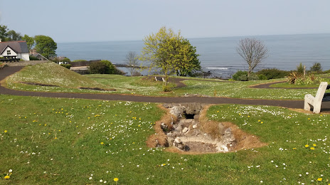
Photo
Where is located Chaine Park
Chaine Park — local attraction, which is located at 124-132 Glenarm Rd, Larne BT40 1EF, United Kingdom and belongs to the category — park. Average visitor rating for this place — 4.5 (according to 99 ratings, information from open sources and relevant for 2022).
Exact location — Chaine Park, marked on the map with a red marker.
You can get directions to Chaine Park on the map from your location.
What else is interesting in Larne? You can see all the sights if you go to the city page.
Coordinates
Chaine Park, United Kingdom coordinates in decimal format: latitude — 54.857434940425215, longitude — -5.802952402202861. When converted to degrees, minutes, seconds Chaine Park has the following coordinates: 54°51′26.77 north latitude and -5°48′10.63 east longitude.
Nearby cities
The largest cities that are located nearby:
- Belfast — 30 km
- Glasgow — 148 km
- Dublin
 (Ireland) — 169 km
 - Edinburgh — 203 km
- Preston — 237 km
- Liverpool — 246 km
- Blackburn — 250 km
- Manchester — 281 km
- Sunderland — 282 km
- Huddersfield — 297 km
- Stoke-on-Trent — 318 km
- Sheffield — 330 km
- Telford — 331 km
- Rotherham — 333 km
- Dudley — 361 km
- West Bromwich — 365 km
- Sutton Coldfield — 369 km
- Birmingham — 373 km
- Cork (Ireland) — 374 km
Distance to the capital
Distance to the capital (London) is about — 531 km.