
 Staden
Geest-Gerompont-Petit-Rosière
Grote Hut
Sint-Job-in-'t-Goor
Deidenberg
De Pinte
Pussemange
Peruwelz
Barrière de Champlon
Staden
Geest-Gerompont-Petit-Rosière
Grote Hut
Sint-Job-in-'t-Goor
Deidenberg
De Pinte
Pussemange
Peruwelz
Barrière de Champlon
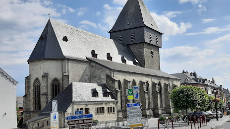
Eglise Saint-Pierre on the map, Bastogne, Belgium
Photo
Where is located Eglise Saint-Pierre
Eglise Saint-Pierre — local attraction, which is located at Pl. Saint-Pierre 19, 6600 Bastogne, Belgium and belongs to the category — catholic church. Average visitor rating for this place — 4.2 (according to 252 ratings, information from open sources and relevant for 2022).
Exact location — Eglise Saint-Pierre, marked on the map with a red marker.
You can get directions to Eglise Saint-Pierre on the map from your location.
What else is interesting in Bastogne? You can see all the sights if you go to the city page.
Coordinates
Eglise Saint-Pierre, Belgium coordinates in decimal format: latitude — 50.00490064895743, longitude — 5.721318825264703. When converted to degrees, minutes, seconds Eglise Saint-Pierre has the following coordinates: 50°0′17.64 north latitude and 5°43′16.75 east longitude.
Nearby cities
The largest cities that are located nearby:
- Liège — 71 km
- Trier
 (Germany) — 71 km
 - Namur — 79 km
- Aachen (Germany) — 89 km
- Maastricht
 (Netherlands) — 94 km
 - Charleroi — 100 km
- Metz
 (France) — 103 km
 - Saarbrücken (Germany) — 125 km
- Bonn (Germany) — 127 km
- Cologne (Germany) — 135 km
- Koblenz (Germany) — 138 km
- Mönchengladbach (Germany) — 140 km
- Reims (France) — 147 km
- Bergisch Gladbach (Germany) — 147 km
- Nancy (France) — 149 km
- Neuss (Germany) — 149 km
- Düsseldorf (Germany) — 154 km
- Krefeld (Germany) — 160 km
- Eindhoven (Netherlands) — 160 km
Distance to the capital
Distance to the capital (Brussels) is about — 135 km.